Acknowledgments
Investigating remote areas in the Libyan Desert causes soaring project expenditures, even if the research is carried out by camel. I thank my dear friend, Jürgen Naumann, for his enthusiastic interest in my work. The extraordinary success of this season´s wanderings would not have been made possible without Jürgen´s funding. For profound advice on the Claytons I thank Marlies Kriegler and Mrs. Hofmann. For attending me as a patient, after I had caught a severe pneumonia in Dakhla oasis, and for guiding me home, I am greatly indebted to Janine El-Saghir. Without her assistance I would not be alive.
A.) Abstract:
The objective of this winter´s expedition was to examine
a.) “a vast area of quarries that contained red and yellow ochres” (Cheop´s Ochre Quarries – COQ), discovered by Giancarlo Negro, Vicenzo de Michele and Benito Piacenza in May 1991 while on their way from Abu Ballas to the El-Baz Crater (see: The Lost Ochre Quarries of King Cheops and Djedefre in the Great Sand Sea (Western Desert of Egypt) SAHARA 16(2005)pp. 121-127)
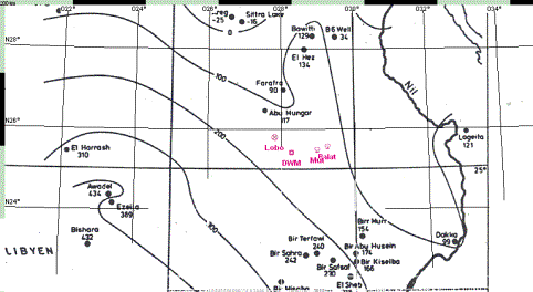
b.) "Abu Ballas II hill (AB2) located between Mut and the Djedefre´s watermountain (DWM), with a large number of keg pots” (ibidem), a site which, according to the authors, lies on an ancient trail which connects Dakhla via DWM, Abu Ballas and COQ with Kufra oasis in Libya.
In summing up their findings Negro et al. ascertain that the discovery of COQ allows to define more exactly the route from Dakhla to Kufra, the so called “Abu Ballas Trail” (TAB) (ibidem), a most disputable proposal, as the TAB already has been carefully traced between Feb. 1999 and Feb. 2003 with the help of my camels. Up to present more than 30 water dumps & sherd-sites, connected with each other by a dense line of road signs (alamat) & remains of ancient tracks, comprise the TAB, which leads from Balat (Eastern Dakhla) to Abu Ballas and further (after climbing and crossing the plateau) to the south-western edge of the Gilf Kebir. Contrary to the suggestions of some authorities the TAB has absolutely nothing to do with caravan routes heading towards Kufra. It passes by COQ in roughly 15 km distance. A side track of the TAB leading to COQ does not exist.
Findings of my expedition:
I.) There is no archaeological evidence for COQ ever having been an (ancient) quarry.
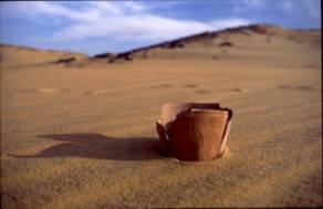
II.) Nothing came to light, that could prove an affiliation of AB2 to the TAB. On the contrary, the hill at which 40 keg pots were deposited in the early Islamic period, is situated on an old camel trail leading from Dakhla oasis to the south-southwest, most probably to Merga oasis.
III.) On this road, which I christened Darb Wadai, a Clayton ring manufactured on a potter´s wheel was found, indicating that the enigmatic objects were in use not only in predynastic & early pharaonic times but also around the 10th century AD. In this report a solution to the Clayton ring problem (based on news facts and observations) is offered.
IV.) In the course of the expedition a forerunner of the TAB was discovered.
Since several requests regarding the publication of TOPs II & III in SAHARA magazine did not lead to a response, the results of my endeavours are presented on my website.
B.) 1st Leg of the Expedition (10/22 – 11/17/2005)
1.) State of affairs at the outset
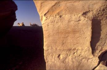
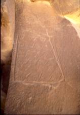
When, in Feb1999, I set out for the discovery of the TAB, I began my search in the vicinity of Mery. To my surprise, I found relics of seven old roads in the neighbourhood of the famous rock, one of which proved to be the TAB.(see Bergmann, C.: Der letzte Beduine.Reinbek 2001, p.378) Another one of fairly modern times leading to the south-southwest consisted of 15-35 grooves left by camels. At Mery´s rock a faint Arabic inscription strikes the eye. (see picture 1) Could this graffito be related to activities of camel drivers having travelled on the latter road? Where would the trail lead to?
picture 1: Arabic inscription at Mery´s rock
Trying to trace a camel route that has fallen into oblivion, very often leads to frustration. Different from donkey caravan routes there is, generally speaking, not much to be found on a camel track. Camel caravans cover great distances per day, which allows for only a few muhattahs (resting places) and, possibly, water dumps on their way. As most of the grooves left by the camels have faded away over time, and as caravan personnel of the Islamic period tended to set up road signs on known trails at random only, it is almost inevitable for the wanderer of present days to loose the track. Therefore I hesitated to pick up the above road.
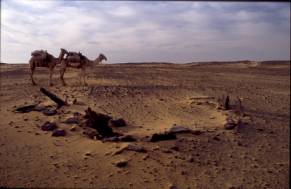
It was not until spring 2005 when I heard of the discovery of a jar deposit about 45 km south-southwest of Mery. Tarek El-Mahdy, who had found the site, named it Son of Abu Ballas (SAB). Surprising, SAB and an alam on a hill about 10km north-northeast of it, which I had detected some years before, were in alignment with Mery. So was AB2, of which Giancarlo Negro gave me GPS coordinates in September 2005. The time was ripe. Chances for a search of the Darb Wadai had brightened.
2.) From Gharb el-Mawhub to Mery
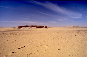
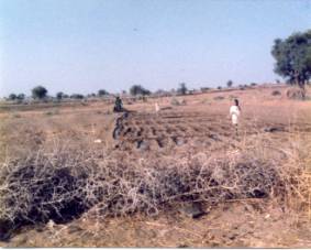
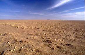
In the afternoon of 10/22/05 I sat out from Gharb el-Mawhub/Dakhla oasis for Mery´s rock alone with two of my camels (Amur and Ashan). Soon we came to the plain, that extends west of Gebel Edmonstone (and west of the dune belt) to the south. The flat expanse was traversed in 1½ days. We followed a line of tiny alamat when ascending a low ridge and, after descending from it, arrived at a flat topped hill crowned with a small cluster of stone circles. This assemblage of hut foundations corresponds with a dozen other settlements (of unknown age) found in the vicinity years before. Not far to the south two old roads, one of which I (in Dec. 1999; accompanied by Ellen Nagel) had traced up to Muhattah Arbaa Mafariq (a station on the TAB), were overpassed. Later, seven kilometres west of Mery the tracks of a big caravan route (at this point running 155/335 degrees) were crossed. A hillock in the neighbourhood, exposing a tiny overhang in its south-eastern slope, had been chosen as a muhattah for the caravans. The site is littered with pot-sherds, bone fragments and a few grinding stones. From here to Mery we passed by a few sandstone hills adorned with (badly eroded) neolithic rock art. A steep foothill of considerable hight, topped with a stone circle settlement, turned out to be unclimbable.
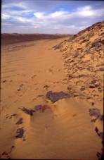
About 4 kilometres east of Mery we reached the TAB. We proceeded along it until the first faint grooves of the Darb Wadai (at this point oriented 195/20 degrees; see pictures 2 - 4) appeared. Its easternmost tracks were passed after 410 metres. This extent alone accounts for a formerly busy route.
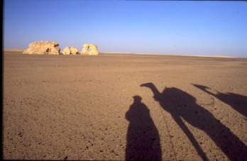
picture 2: approaching Mery
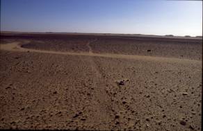
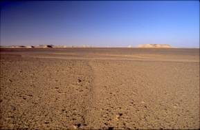
picture 3: Darb Wadai at Mery, view to the south Picture 4: Darb Wadai at Mery, view to the north
Because of hot weather no time could be wasted. The camels were sweating. My water consumption was up to 8 litres per day. Earlier observations had revealed that the Darb originated either in El Qalamun/El Gedida or in El Qasr. (Extensive gravel quarrying at the western fringes of the cultivation zone of Dakhla oasis has made it impossible to trace the old road. El Qasr once had been a terminal on the roads, which ascend through the so-called pass of Bab el Jasmund to the limestone plateau, and then run either to Farafra/Siwa and to Bir Karawein/Bahariya/Cairo or to Beni Adi/Manfalut in the Nile valley (Darb el Tawil).
3.) From Mery to “Black Valley”
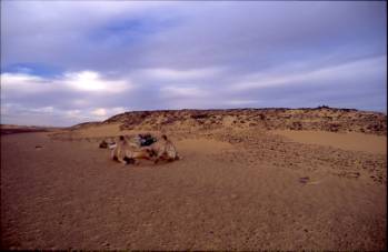
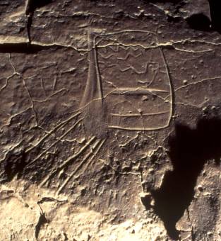
As clearly imprinted into the bedrock the grooves of the Darb Wadai are at Mery, as predictable they vanish when geomorphologic conditions change. Only a few strides to the SSW the desert environs are void of tracks. We nevertheless followed our course, being assured of the right way on two or three occasions by fragments of the old road until, at 3.75 km distance from Mery, a low, tablelike hill was reached (see picture 5).
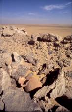
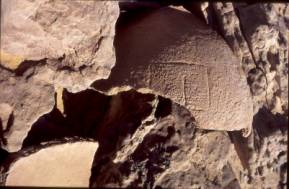
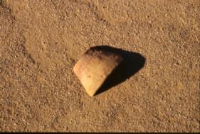
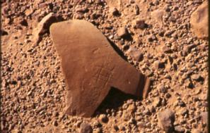
picture 5: Darb Wadai, pottery hill Picture 6: 6th dynasty pot-sherds
A few 6th dynasty pot-sherds, remains of ovoid Abu Ballas-type jars, are scattered on top of it (see picture 6) and along its northern base. One of the sherds shows etchings of a pharaonic wasm (as frequently seen on TAB-pottery; see picture 7). A fragment of Arabic writing occurs on another. (see picture 8) As nowhere else on the Darb Wadai 6th dynasty ceramics turn to light, it seems plausible to assume, that the jars (how many?) once were taken by early Arab travellers from a muhattah on the TAB (most certainly from Mery) to serve their needs on the road to the SSW.
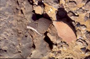
picture 7:Darb Wadai, pharaonic wasm on pot-sherd picture 8: Darb Wadai, fragment of Arabic writing on pot-sherd
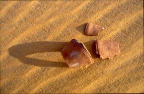
Continuing our survey we soon approached rising ground where, 3.2km from the (6th dynasty pottery) hill, we came upon an alam as well as upon the trail. We followed the old route which, in this section, is well marked by road signs. Before long it divides into two branches. On the eastern branch, at the slope of a wadi bank, its elevation crowned with a disintegrated alam(see picture 9) keg pot-sherds peep out of the sand. (see picture 10)
picture 9: Darb Wadai, disintegrated alam on wadi bank picture 10: keg pot-sherds at foot of a wadi bank
The western branch of the road descends into black valley, a wadi covered with thin layers of sand and dark coloured debris (see picture 11), under which a stratum of bone dry playa emerges. Almost in the midst of this lowland a fairly big sized windscreen had been erected. (see picture 12)
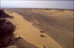
picture 11: Darb Wadai, black valley picture 12: Darb Wadai, windscreen in black valley
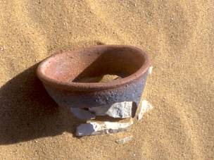
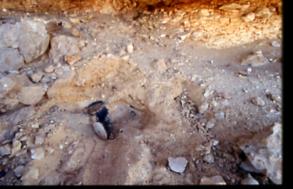
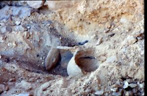
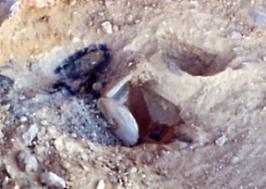
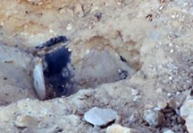
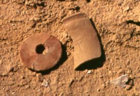
Does this much weathered stone construction account for a resting place of caravans on formerly seasonal grazing grounds? In the vicinity of the structure I discovered sherds of a very particular Clayton ring. (see pictures 13 + 14)
pictures 13 + 14: Darb Wadai, sherds of a Clayton ring produced on a potter´s wheel
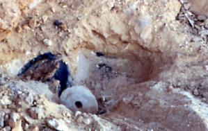
Contrary to late predynastic, respectively Old Kingdom Clayton rings this object is not hand made but was produced on a potter´s wheel. Its lower end exhibits a notch combined with a beaded (roll shaped) rim. Fairly similar characteristics have been observed on Clayton rings found at a site containing 11 “lids” (All “lids” being reutilised sherds from wheel-made pottery; see picture 15) and a couple of severely wind eroded rings (see pictures 16 + 17) on the limestone plateau north of Dakhla oasis. Barring future excavations proving otherwise, the find consists solely of Claytons or fractions thereof. According to my notes (of winter 2001/02 expeditions) no other pottery was noticed within the place of discovery or in its surroundings.
picture 15: exp. 2001/2, Clayton “lids” picture 16: exp. 2001/2, 1st Clayton ring
picture 17: exp. 2001/2, 2nd Clayton ring
4.) A solution to the Clayton ring problem
a.) Limitations of the prevailing paleo-climatic model
Recently, Riemer et al. have assigned manufacture and use of Claytons to an enigmatic, highly mobile population, which crossed the desert in small units by donkey. These groups, the authors put forth, were in contact with local Sheikh Muftah civilization (for instance in Dakhla oasis) as well as with ancient Egypt. (Riemer; H.; Förster, F.; Hendrickx, S.; Nussbaum, S.; Eichorn, B.; Pöllrath, N.; Schönfeld, P.; Wagner, G.: Zwei pharaonische Wüstenstationen südwestlich von Dakhla. MDAIK 61, 2005, pp. 346,347) Allotting Claytons to the movements of small numbers of travellers might, at first sight, be consistent with the reality of the past as, according to the prevailing concepts of the Eastern Sahara paleo-climate, hyper arid conditions in most parts of the Libyan Desert set in irreversibly after 4.700 BC. (Riemer, H.: News about Clayton rings: Long distance desert travellers during Egypt´s Predynastic. Orientalia Lovaniensia Analecta 138, Egypt at its origins. Leuven, Paris, Dudley 2004, p. 985) If such conditions had prevailed by Late Neolithic, Predynastic and Old Kingdom times, they would neither have allowed for semi-desert adapted seasonal subsistence strategies nor for the movement of greater numbers of people across the barren wastes. If there were not innumerable Clayton ring sites all over the Eastern Sahara! Their artefacts account for the presence of humans in areas where (until recently), according to learned opinion, people never could have survived.
The average charge of a Clayton amounts to 0.8 - 1,2 litres. The number of Claytons found at a single site does not exceed 35. What could have been stored, prepared, produced, collected or trapped in such a truncated cone open at both ends, it’s smaller opening at the top “closed” with a perforated disc, which, strange enough (because of its deliberately chosen design) would fall inside the frustum at the slightest touch? What matter broken down into 2-35 units could have comprised the Clayton´s content? Had it been a substance to assure survival in an inhospitable environment? If it was nutriment obtained from the surroundings of the sites, from where did the few lonely souls dwelling in the empty void or traversing it obtain water?
Up to date only three Clayton ring sites have been radiocarbon dated, indicating a Late Predynastic or Early Dynastic age, which clusters around 3100-3200 BC. (ibidem) Such a time horizon raises the question of “what were people doing in the desert some 2000 years after it had become hyper-arid, and how did they survive when living conditions were obviously not sufficient to support…” (ibidem) their resettlement.
Although Riemer laments about “…the general absence of other cultural material at the desert sites in which Clayton rings are found…” (ibidem), such a place exists nearby DWM (containing fragments of Claytons marked with a wasm, 2 perforated disks, pot-sherds, flintstone tools, 4 grinding stones, petrified bones and rock art); another one was found in the outskirts of the Farafra depression. A third one was discovered in 1938 by G.W. Murray in the vicinity of Gebel el-Dukhan in the Eastern Desert of Egypt. (see results of 2004/05 expeditions). These sites expose items, that would serve as indicators for a longer stay “…in a desert without water”. (ibidem, p. 986). I propose to name such sites Clayton camps. In the light of the latter observations one has to take it for certain, that not only along caravan routes (here I found more than 50 Clayton ring sites), where Clayton ring users might have stayed for a short rest only (Riemer´s short-term transitory camps, ibidem, p. 986), but also in areas “off the road” Claytons had been utilised by people, who obviously were in no need to hurry. Most probably, these individuals were dwelling for a longer period of time (for a week, a month or a year?) at one place and then moved “home” (to Dakhla oasis for instance) or to another Clayton camp (thus, if not for “long term”, at least attesting for a seasonal presence), where rings bearing their wasm probably had been stored beforehand. (Later, they would return to any of these sites, where “… pits (or real caches) were used to stock pottery when… their owners were away… The (Clayton rings) were reused when the people were back.” Gatto, M.C.: Two predynastic pottery caches at Bir Sahara (Egyptian Western Desert). Sahara 13, 2001-2002, p. 59) Such seasonal inhabitants of the hyper-arid desert (if they had left traces of their habitation other than Clayton rings, such as manufacturing places, stone circles, hearths, bones, rock art etc.) I propose to name Clayton dwellers.
In order to stay out in the barren wilderness “for long”, it would not have sufficed to load a donkey with a couple of goatskins and to take off from the last well. Could, therefore, Clayton dwellers have relied on rain water for their daily needs in areas, where permanent ground water was lacking? How was the weather really like around 3.100 BC? Although archaeologists have obtained hundreds of radiocarbon dates from the Western Desert, they have to admit, that “…climatic developments after 5000 BC are not yet understood in detail due to the scarcity of climatic archives in the desert.” (Riemer, H., op. cit. p. 986)
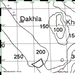
b.) The question of water: DWM/Biar Jaqub, a palaeoasis (preliminary remarks on K.P. Kuhlmann´s article in MDAIK 61, 2005)
There are indications that the Libyan Desert as a whole had not always been as arid as supposed by the prevailing climatic model. Here are a few observations which seem not to comply with a plain-cut (merely linear) extrapolation of the paleo-climate (common around 4700 BC) into the historic period: a.) The builders of the Roman castle at Ain Amur left a wide opening in the enclosure-wall for the bed of the overflow of the former spring (which now is an almost dried up well; see Bergmann, C., op.cit. pp. 195-198, 200-207); an architectural feature which accounts for the Ain Amur creek´s high water bearing capacity (Ain Amur was a solely rain-fed spring, which drew its waters from a stratum of interbedded clays located almost 100m below the top of the limestone plateau. It irrigated quite sizable fields. Ibidem). The erection of the castle neatly fits into the 1st third of the (climatic) “Roman Optimum”; the beginning of the latter tentatively being assigned to the era of the Persian conquest of Egypt. (see picture 43) b.) North of Abu Tartur, on top of the barren limestone plateau, one comes across an unusual large unbent trunk of a tree (which had collapsed decades(?) ago) of approx. 8m in length and approx. 0.90m in diameter. How could such a “giant” have grown at all in a hyper arid environment? c.) When, in winter 1990, I discovered the neolithic rock-art in the Gerhard Rohlfs drip-stone cave (situated on the caravan route which connects Farafra oasis with Asyut), I found its ground strewn with curled clay & loam flakes. Such flakes develop when flooded ground dries, therefore manifesting heavy downpours in the region of the cave, which even penetrated its compact limestone roofing. d.) In the northern part of the Kharga depression, at Umm Debadib and at Ain el-Labakha, elaborate systems of underground water conduits (in Arabic: “foggara”; total length of the Umm Debadib foggara: 14.3 km; max. depth: 53.5 m; volume of excavation residues: approx. 20000 cubic metres) account for rain fed underground water resources which, at the earliest, were tapped after the Persian conquest of Egypt and continued to be utilized way into the Islamic period. (see Bergmann, C., op. cit., pp. 218, 218) e.) Not long ago K.P. Kuhlmann interpreted a graffito at DWM consisting of symbols of a star, of an antelope head, of rainy skies and flashes of lightning as a meteorological notation dating to the 4th dynasty. (see pictures 18 - 21)
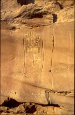
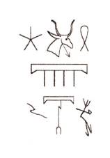
pictures 18 + 19: DWM - meteorological notation and Kuhlmann´s transcription
“It is the earliest historical mention of desert thunderstorms in the area. It is suggested that this meteorological phenomenon gave rise to the camp´s ancient name.” (my translation; K.P. Kuhlmann: Der “Wasserberg des Djedefre” (Chufu 01/1). Ein Lagerplatz mit Expeditionsinschriften der 4. Dynastie im Raum der Oase Dachla. MDAIK 61, 2005, p. 289 ) Moreover, traces where water had leaked from after rainfalls, were found at the flanks of a neighbouring hill. (ibidem, p.269 + plate 42)
pictures 20 + 21: DWM – additional meteorological notation and Kuhlmann´s transcription (rain-clouds and downpours)
Despite this historical as well as geological evidence for a rain fed, oasis-like environment (in Arabic: a so called HATIYA) at DWM and its surroundings, Kuhlman obviously still rejects my proposal, that the followers of Cheops and of Djedefre once had relied on water discharges at DWM and in Biar Jaqub (A spring which dries up, becomes a well; see for example Ain Amur.), while collecting pigments in the region. (It was for the water that the ancients had come to the site. Deposits of polychromatic sandstones and shales could have been exploited with less effort much closer to Dakhla oasis.) However, if there had been a dispute between the Egyptologist and me, whether or not a water source at all had existed at DWM, the argument now has melted down to the question of how large these resources were, to which 4th dynasty expeditions had access during their months long campaigns at DWM.
In 1996 Kuhlmann experienced a thunderstorm, which flooded parts of Upper Egypt and the Western Desert. Between dunes 70km east of Siwa he saw a quite sizable, more than 2 m deep lake, created by the rainfalls. The lake persisted for more than a year; relics of the shrub-vegetation, caused by the incident still to be seen in 2005. (ibidem, p. 270) During 25 years of desert wanderings I myself was victim of heavy rainfalls (one of them lasting 3 days & 2 nights) on more than 20 occasions. More than half a dozen of such episodes provided liquid in ponds and pools, out of which jerry cans were filled and camels watered. Likewise, between 2nd and 5th February 1874 Gerhard Rohlfs and his expedition were held up (and, favoured,) by 16mm of rainfall at Regenfeld. (see G. Rohlfs: Drei Monate in der Libyschen Wüste. Kassel 1875, pp. 165-167)
The DWM “meteorological graffito” reports at least 3 tempests, which afflicted the area, while 4th dynasty expeditions were present. (Kuhlmann, K.P., op.cit., pp. 267, 269) If each of the thunderstorms occurring between 2.580 and 2.570 BC yielded such tremendous quantities of rain as the one of 1996 AD, the hilltops and, particularly, the many square kilometres of playa, which spread between the elevations of Khufu Hills, would have been soaked with water.
Playas are known for their water storing capability. Known is the competence of neolithic peoples to excavate wells of considerable depth into such soil. (see Wendorf, F.; Schild, R: The role of storage in the Neolithic of the Egyptian Sahara. in: Tides of the desert. Köln 2002, p. 44) Why then should Cheops and Djedefre expeditions have refrained from digging after the ponds and lakes created by rainfalls had dried up? It seems quixotic to assume that the expeditions just kept admiring tiny discharges of water from the flanks of a few hills, while squatting on top of a rich aquifer most certainly not more than ½-1m below their feet (Such playa, hard as bone but water bearing, I found at Laqiya Árbain, Northern Sudan. See Bergmann, C., op.cit., p. 256. The Laqiya playa probably is in contact with the ground water table.).
According to Kuhlmann the first Cheops expedition to DWM took place in 19th year of the pharao´s reign (see Kuhlmann, K.P., op. cit., p. 246) and the second in his 20th year (ibidem, p. 250). Three years later the king died. He was succeeded by his son Djedefre who´s reign lasted 9 years. Assuming that the third expedition set out for the west, at the latest, three years before Djedefre´s death, the intervals between the three ventures were reasonable small to allow for sufficient underground rain water reservoirs (stored in the playas), which could have been easily tapped. Therefore the expeditions did not have to resort to collecting liquid cup wise (German: “schälchenweise”!- ibidem, p. 270) from tiny outlets in the slopes of some hills, or to fetch water from Dakhla. (In the vicinity of DWM and in Biar Jaqub quite a number of hills are conically shaped. They display horizontal strata of interbedded clays at different levels of the rock. Such features would allow only for very reduced rates of absorption & penetration of rain water deep down into a hill – with corresponding consequences for the quantities of discharge.)
c.) Watermountain symbols, images of steotopygeous
female
figures and giraffes
In this context I would like to recur to a discovery of a watermountain site mentioned in my report on 2003/4 winter expeditions. The place, situated 1 km west of a low, table like hill topped with a stonecircle settlement (which itself is situated 2.7km south of DWM), consists of 4 small hillocks, each of them not higher than 8m (see picture 22). They are positioned on slightly elevated ground. Although one of the hills is adorned with two watermountains and a steatopygeous female figure (see pictures 23-25. The state of preservation and the colour of the patina suggest that the three engravings belong to the same time period.), it is hard to believe, that the slopes of these hillocks ever discharged any water. There are only a few elevations of the same height in the neighbourhood, the stonecircle settlement being separated from the watermountain site by a flat expanse of playa. If at all, this plain could be imagined of once having housed a well for those who dwelled in the stonecircle village at the other side of the “arable land”.
picture 22 (left): Biar Jaqub – two of “four hillocks”,
the one in front adorned with…(see the following 3 images)
picture 23: watermountain with rotund ends
picture 24: steatopygeous figure on the lower right picture 25: watermountain symbol with pointed ends
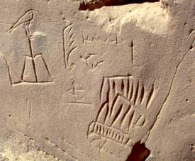
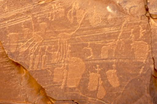
The group of hills and their surroundings are void of pharaonic graffiti. Kuhlmann, rejecting my proposal of a late neolithic/early predynastic origin of the watermountain pictograms, interprets the latter painstakingly as work of art of the 4th dyn. expeditions (ibidem, pp. 271, 275) Moreover, to support his claim he (inter alia) vaguely assigns depictions of steatopygeous female figures to C-group Nubians and, therefore, to Old Kingdom times. (ibidem, p. 262, footnote) Last but not least, he claims to have seen an Old Kingdom(?) watermountain symbol overlaid by a steatopygeous figure (the composition to be found in the vicinity of DWM). If he noticed such a detail, so important as an indicator for an age check, why did he not publish it? What he presents instead, is a watermountain attached to a giraffe´s body and neck. (ibidem, p. 273; picture 37c) An enlarged image of it from my files is shown here again. (see picture 26)
picture 26: Image of a giraffe partly superimposing a watermountain
One can clearly see that the back of the animal has erased the lower left section of the watermountain´s contour. Despite such evidence Kuhlmann affirms the opposite! (ibidem, p. 274) Such divergence in perception is not of neglectable concern. In case the artist damaged the watermountain when drawing the giraffe (as a mystical animal?), the former would be of older age (my conclusion which would support dating the watermountains to a period before the pharaohs); vice versa the image of the animal would be older (Kuhlmann´s conclusion). However, is it at all conceivable that during late neolithic times giraffes still were grazing in the Dakhla region? Could there have existed an isolated habitat, in which remnants of the aethiopide fauna had survived? Or were images of giraffes engraved into the rock for mere ceremonial reasons, hence revealing a concept of wishful thinking associated with fertility or with rain-creating rituals? (Most of the giraffe engravings at DWM and in Biar Jaqub present themselves in a lively & naturalistic style. Therefore it is hard to believe, the artists of the past had visualized the animals from imagination only.) So far, in the vicinity of Dakhla oasis only the bones of an elephant were found in strata of the Bashendi period (between 4050 – 3550 BC; see Churcher, C.S.: Holocene fauna in the Dakhleh Oasis. Reports from the survey of the Dakhleh Oasis 1977-1987. Oxford 1999) thus, at the latest, dating to a period of at least 500 years before the end of the Neolithic. The puzzle becomes even more tricky when focussing on rock art composed of giraffes and steatopygeous figures. On page 24 of results of winter 2003/4 expeditions I published such an image, of which an enlarged version is shown here again. (picture 27) There is no detail in the picture, which bears witness of a pharaonic influence. Instead, the careful observer will identify 4 spots, where images of steatopygeous female figures are superimposed by engravings of giraffes. (The picture gives the impression of a quite incidentally chosen and not of a purposely planned arrangement of human figures and animals, a fact which accredits for a lively and genuine piece of rock art.) In addition, at DWM proper Friedrich Berger identified a steatopygeous female partly superimposed by a softly pecked animal, probably a giraffe (pers. comm.). If this is so, Kuhlmann´s proposal that steatopygeous figures as well as watermountain symbols could be assigned to artists of historic times (either to members of the Cheops/Djedefre expeditions or to C-group Nubians), would (despite the Egyptologist´s detailed epigraphic analysis) still await its verification.
picture 27: steatpygeous figures partly superimposed by giraffes
A conclusive interpretation of the history of DWM/Biar Jacqub in the period before the pharaohs and thereafter must be capable of explaining all major relics found in the area in a holistic and consistent way. In Biar Jaqub, for instance, Watermountain Outpost No. 7 (WM7), which I discovered on 12th February 2002, awaits such explanation. WM7 which is situated almost 8 km southwest of DWM, consist of a stonecircle settlement on top of a high hill. The “village” contains 23 stonecircles and 3 “squares” cleared of and fenced in with pieces of rock. It is protected on three sides by roughly 10m high, vertical cliffs. Almost in reaching distance, below the crest of the east-facing cliff, two watermountain symbols, water waves, two steatopygeous figures, vulvae, an image of a hut(?), giraffes and other wildlife species were engraved into the rock faces. One of the watermountain symbols displays the same colour (reddish-brown) as known from rock art at DWM. A remarkable amount of petrified bones and other cultural remains are scattered at the foot and across the slopes of the neighbouring hill. (see picture 28)
picture 28: cultural remains in the vicinity of WM7
Standing at the base of WM7, one hardly will notice the rock art high up in the eastern cliff. It is self-evident, that the engravings had a meaning for those, who dwelled in the stone circles. Most certainly these people were the creators of the majority of the images. They surely were no members of a 4th dynasty expedition. (There is not the slightest reference to the pharaonic civilization.) Were they C-group Nubians? In this case the latter once should have had a verifiable hold on Dakhla oasis. As reported earlier, a well marked, very old donkey trail equipped with comfortable muhattahs (Tariq Khufu, see results of winter 2003/4 expeditions) leads from Biar Jaqub to Mut which then, one might speculate, C-group Nubians could have had established and used. However, nothing precise is known of their lasting influence on Dakhla oasis. (The question whether or not C-group Nubians in sufficient numbers had been roaming the Western Desert in ancient times is difficult to answer. Darnell & Darnell found evidence for the presence of Pan-Grave Nubians on the desert roads leading from the Nile valley to the west. (see Darnell, J.C.; Darnell, D.: The Theban desert road survey (The Luxor-Farshut desert road survey) 1997-98 annual report. http:/oi.uchicago.edu/OI/AR/97-98/97-98_Desert_Road.html) May this problem be left to the experts who, one day, might find an appropriate answer.) So far, there is safe evidence only of the Sheikh Muftah as a major ethnic group during “the last years” before dynastic rule and beyond. Therefore I am still inclined to advocate, that it were the members of the Sheikh Muftah “…as an indigenous population from the oases… that… were very experienced in desert travelling…” (Riemer, H., op. cit., p. 978), who once had been dwelling in the region of DWM/Biar Jaqub.
To sum up: In his painstaking analysis (predominantly based on epigraphic and textural study) Kuhlmann obviously recurs on parts of the geological features so characteristic for DWM/Biar Jaqub (The Egyptologist tends to pick out such details which support his interpretation of a possible meaning of the “term” watermountain.) and neglects others, in particular the playas. These earthen strata which, in parts of the environs of DWM, once measured up to 9m in thickness (see pictures 46, 47 in “Bildergalerie” and picture “Biar Jaqub: playa underlayed by interbedded clays” in results of winter 2004/5 expedition), had been eroded by wind and sand long ago. They ought to have existed “in full size” at the time of the 4th dynasty. Their hundreds (if not thousands) of tons of liquid content ought to have been utilized in ancient times by anyone with brain in his head. Some of the latter individuals could have been among Kuhlmann´s translators, look-outs or scouts (Prof. M. Verner´s Sa-Wadjet and Ikepi; see “Wilkinson´s zweites Zerzura”, pp. 38,39), who immortalized themselves by adhering their professions (or names) to rock art, which I have interpreted as a map or an ancient land register. (see “Wilkinson´s zweites Zerzura” p. 39 and pictures 49-54 in “Bildergalerie”) Also nowadays it is not uncommon for lower ranks of the Egyptian military stationed at nuqtas on the Western Desert road to entertain themselves by maintaining a small plot of land. Even if water has to be carried from a distance, and even if the ones who sowed do not harvest and benefit from the fruits of their labour, laying out such tiny gardens and irrigating them according to the Nile-valley-tradition is almost inevitably performed. Does such behaviour hint to a deep seated cultural trait of the Egyptian peasant who, when far away from home in foreign lands, obsessively reproduces an environment with his own hands to which he has been familiar on his native soil?
By the way, in 1983/84, when marching across Western Sudan during the Sahel drought, I noticed a lady and her young boy irrigating a small garden measuring not more than 20x12m. The well, from which the two individuals were drawing water, was situated at the garden´s fringe (hidden behind the thorn fence in the front of the photo). It had been drilled only a few metres deep into the soil. Picture 29 gives an impression of the “hand irrigation process” showing the lady (in the distance on the left) carrying a goatskin full of water to the sprouts. The garden, bare as it looks, was maintained for the survival of a family during the drought; it was not kept for pleasure.
picture 29: Western Sudan in 1983/84; irrigating a plot of land by hand
Is it not conceivable that similar procedures had been a common practice at DWM/Biar Jaqub in late neolthic/early dynastic times?
d.) Clayton rings as items facilitating desert survival
How did a Western Desert playa look like after a series of heavy rain falls? Taking the topography of DWM/Biar Jaqub as an example, one easily will visualise an environment consisting of temporary lakes, ponds and swampy grounds, the latter being covered with a “rich” carpet of reeds (and, after having dried up, with), grasses, agul (Surprising, since two decades a small plot of agul-grazing exists on the limestone plateau a few kilometres north of Very Steep Camel pass, Dakhla oasis.) and a variety of herbal plants and bushes; a “blossoming” desert steppe in which, here and there, tamarisks and acacias cast their shadow. Such a “lost” oasis, a so called Zerzura, survived as long as local & periodic rainfalls did not cease. It could exist “for ages” in locations where abounding water was stored in thick strata of playa underlayed by impermeable clays.
Note: That Wilkinson´s 2nd Zerzura most probably was not a groundwater fed oasis, is illustrated by Friedrich Berger´s tentative geological & topographical analysis of the area, which I cite here:
“On the Russian map, sheet G-35-Г (G-35-G), Djedefre's Water Mountain lies at an elevation of about 220 m in an area with a general slope to NE towards the Dakhla depression. It is possible that some relatively small pools developed here after rains. About 25 km SE from DWM there is a depression below the 200 m line… About 30 km E and NE of DWM there are marks on the Russian map indicating sebkha-facies. In the… depression area Meissner et al. (1993) interpreted from satellite pictures Quaternary playa and semi-lacustrine deposits. All these indications still have to be checked on the ground…The Dakhla-basin is part of a huge aquifer system in the Nubian sandstone covering N-Sudan, SW-Egypt and SE-Libya. On the basis of data collected by Ball (1927) and Sandford (1935) Brinkmann et al. (1987:471) interpreted the groundwater level of today… Picture 30 shows an extract with the locations discussed here. The 200-m line runs from NW to SE and passes DWM in a distance of about 100 km to the SW. Obviously there is no groundwater at DWM. The 200 m line must have been more to the NE in the past, as the archaeological site Lobo was a spring and later a well at a similar elevation as DWM. The last occupation phase was about 6100 bp (Klees, 1989; Midant-Reynes, 2000:147-148). Similar springs/wells may have existed near DWM, but the area is not well explored.”
picture 30a: Groundwater contour lines after Ball (1927) and Sandford (1935)
picture 30b: Simulated groundwater contour lines for the Nubian Aquifer System 8000 year B.P. (detail)
Pictures 30a + 30b are quoted (and modified) from a.) Brinkmann, P.J.; Heinl, M.; Hollander, R.; Reich, G.: Retrospective simulation of groundwater flow and transport in the Nubian Aquifer System. in: Berliner geowiss. Abh. (A) 75.2, p. 465-516. Berlin 1987 b.) Ball, J.: Problems of the Libyan Desert. Geogr. Journal 70, pp. 21-38, 105-128, 209-224 c.) Sandford, K. S.: Sources of water in the north-western Sudan. Geogr. Journal 85, pp. 412-431 d.) Heinl, M.; Thorweihe, U.: Groundwater resources and management in SW Egypt. in: Meissner, B.; Wycisk, P. (ed): Geopotential and Ecology – Analysis of a desert region. Catena supplement 26, Cremlingen 1993.
In the meantime additional information became available. A track of GPS data indicates that the elevation in the above depression does not fall below 200 m, the elevation in the Russian map is underestimated. In the depression with playa-deposits several dead bushes were found, probably 100 – 300 years old.
Riemer et al. specify the altitudes of the Dakhla depression: 100m; of the pharaonic desert police station: 194/196m; of the plain stretching south of Gebel Edmonstone: 145m (see Riemer et al.: op. cit. p. 298)
Let´s leave aside the period of about 6100 bp and beyond and concentrate on the effects of rain fall on DWM/Biar Jaqub during historic times. Although a lacustrine phase in the Dakhla region (which, according to the prevailing model, had existed between about 8000 – 3500 BC) can be ruled out during the era of the pharaohs and thereafter, heavy rains had been a noticeable feature around 2500 BC and later. For a scenario described above a few finds bear witness:
a.) A while ago I learned from desert travellers, that sizable remains of trees were discovered on a small playa in approx. 10 km distance from DWM. The wooden matter yielded C-14 dates of 1604-1524 BC, 1729-1621 BC respectively, suggesting scattered groves of trees in the Biar Jaqub area during Middle Kingdom times. These datings give faint reminisce of the story of Chunanup, the eloquent peasant who travelled from Sachet-hemat (Wadi Natrun) across the desert to the Fayyum with his donkeys during the reign of pharaoh Nebkaura, a 10th dynasty king. (see Kurth, D.: Der Oasenmann. Mainz 2003, p.12) On his way he passed through Wadi Farigh, where during Roman times a river (Lycus fluvius) bordered by arable land was still flowing. (ibidem, p. 14)
b.) At WB 2 gazelle droppings of unknown age covered by sand were found at the base of the rock picture “Vogelkopfwesen” (see picture 57 in “Bildergalerie”). The droppings attest for the presence of grazing desert animals sometimes during the past.
c.) In December 2004 Friedrich Berger detected a sickle in the southern section of Biar Jaqub. (see picture 31; www.aars.fr, pictures, Neues von Djedefres Wasserberg ) Berger believes that the object may be as old as the dead bushes in the depression mentioned above (100-300 years; pers. com.) The find confirms the perception that a grass vegetation had existed, which could have been mowed down at the time when the sickle was accidentally left in Biar Jaqub, or which (in case of loss of the tool) was expected further to the west. Since the first days of my desert wanderings I myself have used to carry a similarly shaped sickle in my saddle bag, just to be ready to cut grass for the camels in case we happen to come across a spot of vegetation.
picture 31: sickle found by F. Berger in the southern section of Biar Jaqub
If the sickle´s age has been dated correctly by the discoverer, the find would attest for the existence (of a Hatiya) of Wilkinson's second Zerzura, “…which was said to be in a distance of two or three days walk straight west of Dakhla. The distance is certainly right”, remarks Berger, “but we did not see the small black-and-white bird…” (pers. com.); feathered creatures, for most desert travellers an absolute prerequisite for acknowledging Zerzura´s reality. In any case, a date of about 200 years certainly would support the notion, that the individuals interviewed by Sir Gardner Wilkinson around 1830 might have seen with their own eyes, of what they had reported to the British Egyptologist. Moreover, the Clayton camp which I discovered in the vicinity of DWM bears witness of the fact, that Zerzura, in the guise of DWM/Biar Jaqub was known and frequented not only in Islamic times but also in a distant past, when a few “sand dwellers” sat up their camps (and settlements; see report on winter 2003/2004 expeditions) for an (up to date) unknown span of time.
Although the stone circle settlements found in Biar Jaqub account for a population of at least 200 inhabitants, Wilkinson´s 2nd Zerzura, for long periods of its prehistoric past, had not been a land of milk and honey. The extensive playas and the immense amount of grinding equipment dispersed all over the area do give the impression, that after rain falls a fair amount of crops (such as emmer wheat) was harvested. Quite a distance west-northwest of Biar Jaqub, on higher ground, one even comes across elongated lines of stones arranged to huge squares and rectangles, the entire configuration (probably much older than any of the Zerzura settlement remains) reaching out to the horizon. Such manmade stone structures cannot considered to be hunting fences; instead they, most probably, indicate formerly fenced in fields (similar to the ones found in northern Mesopotamia, where they, according to the latest archaeological interpretation, bear witness of the earliest large scale farming activities of mankind). If this is so, Biar Jaqub and its surroundings could be envisaged as a location where, from the beginning of the “Neolithic revolution” to the dynastic period, climate-adapted cultivation activities had taken place.
Where there are fields, there are weeds as well. When rain falls cease and aridity causes crops to wither, some weeds will survive. Picture 32 gives an impression of how Bisharin farmland in the Eastern Desert of the Sudan has deteriorated after 3 years of drought.
picture 32: Eastern Sudan in winter
2004/5; Bisharin farmland after
three years of drought. Stretch
of colocynth vegetation, a few sqkm in size.
The “weed” which had survived the rainless period were colocynths (in this report the pumpkin like fruit of the colocynth is called “handal”, the latter term being the Arabic name for the plant). Colocynths are overrunning the sandy terrains of Nubia and Upper Egypt after rains. They are found on native soil and on playas. Father Theodoro Krump, missionary and physician who, in 1701, traversed the deserts west of the Nile on his way from Egypt to Ethiopia, reported from the Moshu-to-Dongola leg of his journey: “In these uninhabited deserts we found the colocynths…” (in old-fashioned 17th century German: “In disen unbewohnten Wüsten haben wir die Coloquinten/welche wie die Gugumer in denen Feldern/und sandigen Erden wachsen/nicht weniger die edliste Senna-Blätter/welche an kleinen Stauden/so denen schwarzen Beeren nicht vil ungleich seynd/gleichsam als ein Unkraut in solcher Menge wachsen/daß man so wohl von einen/als auch dem andern ganze Schiffe beladen kunte.“ see Krump, P. F. Th.: Hoher und fruchtbarer Palm-Baum deß Heiligen Evangelij. Augsburg 1710, p. 236) Their fruit has “…been used for food by the poorest Saharan tribes, after being deprived of all the pulp and heated by boiling, roasting, or baking.” (Felter, H.W.; Lloyd, J.U.: Colocynthis (U.S.P.) – Colocynth. King´s American Dispensatory 1898) Hassanein Bey relates the story of Bukara, a Bedouin servant belonging to his caravan, who did not bother with such preparation techniques and suffered the consequences: “…he had been entrusted with some fifty camels to take to Ouenat for grazing. He was alone and ran short of food. ´For twelve days I ate no meal, except the pips of colocynth, which upset my digestion… Then I reached Kufra´.” (Hassanein Bey, A.M.: The lost oasis. London 1925, p. 209) The Goran tribes used to feed on abra, which they “…made out of colocynth, boiling the pips to get rid of bitterness and then crushing it along with dates and locusts.”(Ondaatje, M.: The English Patient, New York 1992, p. 249) Surprising, date stones were unearthed in the course of an archaeological dig at Muhattah el Homareen, a station on the TAB. Innumerable relics of locusts were found in a trial-trench at DWM. (see results of winter 2004/05 expeditions) At the latter site (see Riemer, H., op. cit., p. 928) and at most of the muhattahs on the TAB, as well as at the pharaonic desert police station (see Riemer et al., op.cit., p. 305, 306-307, 346-307), which I discovered (in winter 1999) in half a day´s walking distance west of Dakhla oasis, complete Clayton rings or fragments thereof were detected. Kuhlmann translates an inscription at DWM as “the leader and the overseer of the date processing...” (Kuhlmann, K.P., op.cit., p. 266) and interprets “date processing” as “preparation of sweets”. But why should the date stones not have been utilised by 4th dynasty expeditions in a way as described above? In the light of the DWM-locust find the Egyptologist envisions the grilled insects as nourishing food for destitute desert dwellers. Recurring on Plini we learn, that the poorer among the ancient Ethiopians once fed on locusts which, after being made durable by roasting and salting, sufficed as food supply throughout the entire year. (Plini, Nat. Hist. VI, XXXV,195) Herodotus records such an observation when portraying the Nasamones who, while traversing the desert with their date caravans, fell back upon a similar practice. (Herodotus IV, 172) During their Theban desert road survey Darnell & Darnell discovered a large deposit of pottery and organic remains at Gebel Qarn el-Gir (see Darnell, J.C.; Darnell, D., op. cit.). The site obviously had been used as a muhattah, respectively as a ”…customs center and weighing station at… the junction of the Theban route and the oasis roads” during the 18th and up to the 21st dynasty. (ibidem). Among the organic material “emmer wheat, barley, lentil, cucumber, watermelon, date, fig, acacia and colocynth” (ibidem) were identified. Although the report releases no details about the pot-sherds of various types and sizes, I would bet that there are fragments of Clayton rings among them. (“…it is more difficult to identify a Clayton ring (fragment) among potsherds in a settlement.” Riemer, H.; Kuper, R.: “Clayton rings” – enigmatic ancient pottery in the Eastern Sahara. Sahara 12(2000), p. 94)
In case of need crushed handal has always been utilized as forage (a practice which I observed myself during winter 2004/5 expedition in drought stricken Eastern Sudan). As shown above, (properly prepared) handal seeds, exclusively consumed or mixed with crushed date stones and roasted locusts, had been a basic staple for those traversing the desert or dwelling in it. Two of the ingredients of such meals (handal and locusts) had been of ubiquitous occurrence in a drought stricken void of the past; dates could have been conveniently obtained in any of the Western Desert oases as well as in the Nile valley. (Confirmation of cultivated dates in Egypt reaches back to Middle Kingdom times only. See Riemer et al., op. cit., p. 329)
The above studies give rise to the following preliminary conclusions: Stretches of colocynth vegetation as seen in the Sudan in 2004/5 ought to be interpreted as ever-ready natural granaries, which were capable of bridging periods of severe drought by providing a nutriment in an extremely arid environment. In locations, where water was available, such as on the TAB (jars as water storages) or at DWM/Biar Jaqub (playas as water storages), the occurrence of handal as a source of protein & fat for food and feed allowed for “long term” abodes (“hut” semicircles are found for instance at Muhattah Jaqub; a simple stone construction exists at Muhattah Umm el Alamat) in an otherwise hostile setting. Thus, sizable ranges of colocynths permitted individuals to stay in the desert and to “wait for” the next rain to fall. In those parts of the desert where water was not at hand, but had to be carried along (or where water was considered an extremely scarce commodity for whatever reason), handal was used for food and feed during the stops at the resting places of the caravans.
e.) Clayton rings as handal pip roasters
At many of the above sites Clayton rings were detected. Could these items be envisioned as appliances for the preparation of handal pips? Thus, could they have served as “kitchen equipment” for the sand dwellers as well as for the personnel of ancient caravans?
On a camel trip in January 1996 we strolled along a rocky wadi situated in the outskirts of the Farafra depression. I was accompanied by a very enthusiastic but incompetent Egyptologist. The wadi´s direction is 200/10 degrees. It´s bed is about ½m deep, 15m wide and 5 km long. Its mouth drains into a mudpan (about 1.4km to the north of the place of discovery). Two stunted acacias cast their scanty shadows on the wadi´s western bank. Here and there in its path the dry river bed strikes low limestone boulders (meandering along its eastern side), where erosion has carved out a few rock overhangs. Below such a 70cm high and 1,60m deep abri I found Clayton ring-sherds. In those days the items neither had a name, nor did there exist an idea to which period they could be assigned to. On my wanderings I had seen many of them. Their (in most cases) perfect state of preservation supported the notion of recent age. I believed they would belong to hand made Bedouin earthenware of Islamic times.
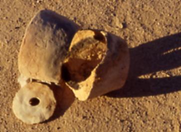
Still, the find had to be documented properly. I asked the Egyptologist not to touch anything before I had fetched tripod and camera from a camel´s saddle bag. However, when I returned to the place of discovery, the individual already had unearthed a number of Claytons which, most certainly, had been intentionally buried in the sediment. Because of this failure a sequence of photos illustrating the recovery of the objects does not exist. With regard to the importance of the find 5 images taken from different perspectives after the “lifting” of 3 Claytons are presented here. (see pictures 33-37)
picture 33: general view of the Egyptologist´s “excavation” picture 34: 1st perspective
picture 35: 2nd perspective picture 36: 3rd perspective
picture 37: 4th perspective
Fortunately I managed to stop the Egyptologist`s ill attempt before the pit had fallen in complete devastation. In picture 35 one will easily identify the “in situ impressions”, which 3 Claytons had left after their extraction. In addition, all pictures exhibit the in situ position of a “lid”, which (contrary to observations made elsewhere) marks the narrow end of a Clayton. The images also reveal a remarkable accumulation of charcoal-rich sediment, into which the Claytons had been imbedded. According to my notes of January 1996 (which, because of the trouble with the Egyptologist, are slightly confused) the interior surface of one of the Claytons found nearby in a second pit, was covered with a thin & even layer of charcoal. A Clayton-sherd seen in the wadi bed proper, exposed an image of a dog or of a donkey(?) as wasm. Another one close by was adorned with a pr-sign and a circle. At a ledge of the eastern limestone bolder a Clayton presenting an “Isis-knot”(?) wasm was detected (picture 41). Pictures 38-41 display further examples of wasms.
picture 38: “comb”-wasm picture 39: “field”(?)-wasm or meaningless(?) engravings on pot-sherd with beaded rim
picture 40: wasm of pharaonic period appeal on sherd with rim picture 41: wasm with allusion to an “Isis knot”
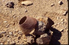
One of the Clayton rings from the site shown in pictures 33-37, which I could wrest from the hands of the Egyptologist before the individual had emptied it completely, was thoroughly filled with a yellowish mass (For identification purposes this Clayton ring will be named Farafra-Clayton). Its outer surface displayed a wasm which appeared to us as an allusion to an amphora. When I got hold of the object, all its loose content had come out. Nevertheless, a remarkable portion of it had remained inside the Clayton and loosely adhered to its interior surface. (see picture 42)
picture 42: Clayton ring containing yellowish
mass
and adorned with an “amphora-wasm” + perforated
disk.
The substance was not burnt. No remains of charcoal were to be seen inside the Clayton. Such evidence strongly supports the conclusion, that the Clayton´s content, if at all in contact with a charcoal fire, had been exposed to moderate heat only.
The brownish matter surrounded by charcoal (best seen in pictures 35 + 36), on which the Farafra-Clayton was standing(?), has been analysed yielding the following data: Amorphous organic substance of brown colour being a decomposition product of oxidizing action (TC% 1.4; IC% 0.25; TOC% 1.15) and containing “fossil” pollen and spores: alder-tree (Alnus), “sour”-grass (Cyperaceae), monolete and trilete fern, birch-tree (Betula) elm-tree (Ulmus) as well as a few algae-cystes. These species represent a moist environment. Is such a desert habitat at all conceivable for any span of time at the beginning of (and, later, during) the historic period? Or had those pollen and spores been subject to long distance aeolian transports (from Europe?) before they mixed with old lacustrine deposits in the vicinity of Farafra? How had the lacustrine material itself arrived at the overhang? Had it too been deposited by wind action once? The place of discovery is situated about 300m east of the wadi bed, to the west of which (at 0.5m above the wadi bed) a flat expanse stretches. It is difficult to imagine that all this terrain, which spreads out 2-2.75m below the find, had been the bottom of a former swamp or lake. The charcoal has not been dated yet. From the yellowish content of the Farafra-Clayton (which is of a different compound than the brownish matter described above) it is known so far, that it consists of a disintegrated organic substance. Is it decomposed handal pips? The answer to this question has to be left to future endeavours of archaeobotanists.
The environs of the place of discovery are such that they, most likely, never had been intersected by caravan routes. There are neither grooves left by camels or by donkeys, nor are alamat to be seen in the surroundings of the wadi. Instead, the landscape supports the notion, that once upon a time people had dwelled in the region. Judging from the presence of stone tools etc., the place of discovery certainly qualifies for a Clayton Camp.
The observation of an organic substance as content of the Farafra-Clayton is startling. As far as I know, there are only two plants existing in the Libyan Desert of today, which could be utilized as natural protein storages for food and feed long after rain falls have ceased: Handal and so called “Kam´a” or “Faqa´a” Of the latter plant, which grows at the fringes of dunes and which supposedly develops potatoe-like fruits, I recently learned from an Egyptian TV-producer. I have not noticed the plant myself. Its botanical name could be Lxodinae CL Koch Haena plysalis subterra Hoogstraal. Muschler describes an annual plant, to which the local name faqa´a is attributed (Astragalgus eremophilus). It grows in deep sandy places but it develops no patatoe-like fruits. (Muschler, R.: A manual Flora of Egypt. Berlin 1912, pp. 518, 519) In Taekholm´s Student´s flora of Egypt there is no mention of it. So, for the time being, its nutritive value cannot be ascertained.
In any case, because of a preliminary determination of the remnants of a Clayton ring´s content as consisting of organic matter, the function of the enigmatic rings as traps certainly has to be discarded. Instead, the data so far collected offer a solution, strongly implying that the objects had been used for food preparation, particularly for the roasting of handal seeds.
f.) The execution of handal pip roasting
In results of winter 2004/5 expeditions I acquainted the reader with handal furnaces, utensils for the production of gotran (handal tar or handal oil. Handal pips are utilized as an oilseed, see http://en.wikipedia.org/wiki/Colocynth). The latter is used for impregnating girbas. I myself had seen the malodorous liquid being applied to goat skins. As a member of Sudanese camel caravans in winter 1982/83 and winter 1983/84 I had consumed water from such girbas with much distaste. To collect gotran without loss, handal furnaces are set up either on flat solid rock (see picture in results of winter 2004/5 expeditions) or, in the absence of the latter, on stone slabs.
While in a handal furnace the oily & unhealtful ingredients of the colocynth are extracted at fairly high temperatures and later utilized, a Clayton ring is used as an apparatus to get rid of such components by purifying a charge of handal pips from harmful elements, therefore transforming the pips into edible matter. Heat fissures along the lower end of a Clayton have rarely been observed, indicating that the refining process had been carried out at “modest” temperatures. (see also observation reported in chapter 4e) The handal´s toxic elements separated either by evaporation or trickled down. For this reason the Clayton ring
a.) has no bottom
b.) is equipped with a perforated “lid”.
In addition, the perforation in the “lid” serves as a finger-hole which facilitates a few manipulations, such as entering the Clayton with the disc and exerting pressure on its content while the pips are roasted. For this reason the “lid´s” contour has been carefully adjusted to the Clayton´s smaller opening at the top, so that it would slip through easily when held in a slanting position.
To sustain the refining process at “modest” heat and to keep the charge clean, a glowing fire was covered with a layer of native soil or (if at hand in prehistoric times) with sand, on which a filled Clayton was placed. This layer also prevented the carbonising of the handal seeds. A similar procedure is known from Bedouin bread (Arabian pita bread) baking, where the dough is put on heated sand and then covered with a coating of the same substance. For pita bread production a baking form is not needed which, because of roasting a granular matter, is an absolute necessity in case of handal pip refining. If the handal kernels were not confined in a form (i.e. the Clayton), they would easily get lost in the sand while being turned during the roasting process. Furthermore, they also would not be equally exposed to heat from all sides (which is guaranteed by the oven like form & function of the Clayton). To control such equal process-conditions in an (almost) closed milieu the perforated disc belonging to each Clayton also serves as a lid.
If all phases of the roasting process were performed in a proper way, a hungry sand dweller could relax, lean back and enjoy his “stuffed Clayton with handal pips”. In the absence of other cereals such refined nourishment could have been consumed in big quantities and over longer periods of time, hence allowing for extensive stays in the desert without being forced to retreat to a major oasis simply and solely because of lack of food.
Note: The above procedure illustrates that, if normal caution had been observed, no remains of handal pips would stick to the inner surface of the Claytons. As a Clayton´s content usually did not get burnt, the rings, much to the astonishment of archaeologists, stayed clean: “…remains of their content or any related features like pits were not observed.” (Riemer, H., Kuper, R., op. cit., p. 95) “Neither in the surrounding sediments nor at the inner surface of the rings any remains of contents have been observed.” (ibidem, p. 99) In this context the discovery of the Farafra-Clayton must be regarded as rare exception. The find, in conjunction with two meteorological notations at DWM, and a visit to the Sudan, has provided the clue for solving the Clayton ring problem.
g.) Clayton rings as climate indicators
It already has been noted that the prevailing climatic concepts for the Western Desert insufficiently model meteorological events of the predynastic & early historic past up to late medieval times (see chapters 4a + 4b). For the period between 5000 BC and thereafter first cautious acknowledgements of error are found in Riemer et al. (op.cit. pp. 332, 342,343) and in Riemer (op.cit., p. 986: “It can also not be fully excluded that short periods of more rainfall during this hyper-arid phase encouraged new activities in the desert. Unfortunately, climatic developments after 5000 BC are not yet understood in detail due to the scarcity of climatic archives in the desert.”). Since years, observations of my own have thrown doubts upon some findings published by university based experts. I have repeatedly suggested that some of their assumptions are at odds with the reality in antiquity. (see Bergmann, C.: op. cit. pp. 440-442; see also previous reports on this website) The widespread occurrence of Claytons in areas, which depopulated after 4700 BC., augments such scepticism. However, Clayton ring sites, of which an estimated 400 (including the ones seen by off-road tourist agencies) have been found in the Western Desert up to now, also open a chance to straighten such misunderstandings and faults.
The almost ubiquitous presence of Claytons and their distribution across the Western Desert could contribute to an increasing knowledge about climatic fluctuations during the above period if, for instance, the search for Clayton camps (as sources of C-14 datable material) would be conducted in a more intelligent way. Regarding Clayton camps Riemer´s reasoning leads to nothing, when he concludes: “The presence of hearths, manufacturing places, grinding equipment, among other features, which are so characteristic of the prehistoric sites of the wet-phase, that would serve as an indication for a longer stay and exceptional camp site activities do not occur at Clayton ring sites.” (Riemer, H.: op.cit., p.986) Where, if not in close association with Claytons, could such equipment be found? If the reader turns back to the environmental situation exposed in picture 32, it would become evident, that a Clayton dweller most certainly would not leave his rings at the particular place (here: on a huge playa) where he had camped, but at the two hills (in the background of picture 32) or at another land mark which, even after years of absence, he or his folks would easily be able to identify. Only in regions where such land marks do not exist (Of a tree or of a bush erosion might have left no trace after thousands of years.) Claytons are found as “misplaced” in the middle of nowhere. The latter perception alone, indicating mere helplessness, demands the development of fruitful concepts for screening out Clayton camps as well as ancient caravan routes, on which many of the Claytons had been deposited (short-term transitory camps).
At this point it appears suitable to anticipate one result of the expedition. Barring the observations at the (6th dynasty) pottery hill (see beginning of chapter 3) the entire pottery found on the Darb Wadai (including the dumps of keg pots at SAB and AB2) belongs to the early Islamic period. It consists of only one type (keg pots). At first glance I estimated, that the earthenware could be dated to around the 10th century, a finding of which I informed Giancarlo Negro shortly after the end of the expedition. Meanwhile I learned that a TL-date of 1100 +/- 20%, equivalent to 880-1320 AD, has been obtained from a SAB-potsherd, which pretty much corresponds with my estimate. Would it be consistent to date the Clayton found in black valley to the latter period as well? Yes, I believe so, because all utensils on the Darb Wadai are of a single make. This is a deciding factor. It does permit the employment of comparative or indirect dating (German: relativchronologische Erfassung).
The proposal of a 880 –1320 AD provenance of the black valley Clayton seems justified as
a.) so far, no Clayton similar to the one in pictures 13 + 14 has been discovered in association with items assigned to pharaonic Egypt or, later, to the period, in which Egypt was subjugated under Roman rule
b.) ,most probably, no clay-ware was deposited on the Darb Wadai after 884 AD.
From Arab sources we know that a road from Dakhla to Darfur/Wadai had existed, and that it had been closed by the Egyptian ruler Ahmad ibn Tulun (868-884). “He did this because the route became very dangerous, as many caravans had been lost when covered by sandstorms or attacked by brigands.” (Al Istakhri, Kitab al-masalik wa´l-mamalik, cited from Levtzion, N.: Ibn-Hawqal, the Cheque, and Awadaghost. Journal of African History. IX,2 (1968) p. 232) A fragment of an Arabic text inscribed on a 6th dynasty potsherd (shown in picture 8) points into the direction of an “official” destruction of the jars in order to prevent traffic across wastelands, which had become impassable. Thus, for the purpose of tentative dating it seems justified to take the Abbasid ruler´s order as the most probable point in time, to which the keg pots as well as the black valley Clayton (at the latest) ought to be assigned to.
Note: The Claytons presented in pictures 15-17 could have been in use even after 884 AD, as favourable (local) climatic conditions seem to have prevailed longer on the limestone plateau north of Dakhla oasis than in the “plains” south of it.
If the latter finding is accepted as tolerably correct, then two periods during which Claytons were used, would emerge: 3100-3200 BC (donkey era) and a, so far, unknown span of time up to 884 AD (camel era). As shown in picture 43, these two periods correspond vaguely with temperature changes during the Holocene.
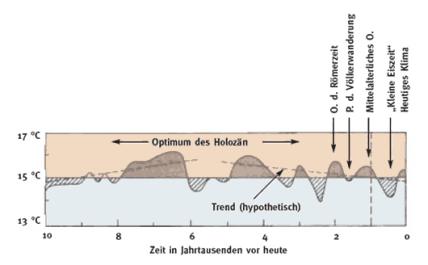
picture 43: temperature
changes during the Holocene (see Schönwiese, Chr.-D.: Klima
im Wandel, Tatsachen, Irrtümer, Risiken. Deutsche Verlagsanstalt
1992; cited from:
http://de.wikipedia.org/wiki/Holoz%C3%A4n
The first period matches with (the 2nd upward-trend in temperature (approx. 3250 BC)) at the outset of the second phase of the Holocene Optimum (approx. 3000-1700 BC), the second occurs at the beginning of the Medieval Warm Period, which lasted from the 9th to the 14th century AD. (see: http://de. wikipedia.org/wiki/Mittelalterliche_Warmzeit) Regarding the Libyan Desert, both periods are considered as epochs of drought. In case of the period of 3100-3200 BC, however, quite a few Clayton finds reveal, that the earthenware had been utilized well into the 1st Intermediate Period. (see Riemer et al., op. cit., pp. 311, 339, 346) Consequently the “rings” turn out to be items of a respective era of decline and extinction; of an age, in which rains and nourishment fell short, thus
a.) putting an end to a specific mode of desert subsistence and, simultaneously,
b.) revealing the persistent urge of man to retain a footing in a barren landscape, even if such a foothold would consist of nothing but the prospect of traversing an expanse that had become a fearful void.
In this respect Claytons also could be conceived as symbols for the last sand dwellers´ will to survive, as well as for the adaptability of those who (in two periods of the past) had been traversing the Libyan Desert.
Note: In March 2000 Riemer and Kuper excavated the site Mirmala 00/10 “…in the remotest part of the Great Sand Sea. On the floor of an interdune valley…three groups (of Claytons) each (of them consisting) of eleven rings, protruded only a few millimetres above the surrounding sand…The clear grouping of the pieces, set close together within three clusters only a few metres apart from each other…with the smaller opening at the top and a respective disk inside…” (Riemer, H.; Kuper, R., op. cit., p. 95) presents their state of use. If one Clayton-fill for one person is assumed, then at Mirmala once upon a time up to 33 people had camped. (None of the potmarks on the Claytons are alike, indicating different ownership of each Mirmala-Clayton.) They would have gathered around three fires, which had been covered with thin layers of sand, on top of which the individuals had put their Claytons to roast handal pips for their meal. The size of each Clayton cluster matches well with the size of an average fire place. If the above calculations are correct, Riemer´s assertion, according to which only individuals in small units had crossed the Libyan Desert by donkey during the 1st Clayton period (see chapter 4a) would be overthrown by the findings of his own former digging.
Surprising, such versatility & tenacity was known in the Nile Valley of the late Predynastic period up to the Old Kingdom/1st Intermediate Period. During this span of time it was known too, that (some) people were still settling deep in the desert, while others were crossing it with their donkey caravans. More than that, it must have been notorious then, that rain did not just occur sporadically, but that the “last sand dwellers”, as well as any desert traveller, could rely on precipitation inasmuch as these rainfalls were (here and there) capable of bringing forth a Zerzura in a, somehow, predictable way. (I am not familiar with the reproduction cycle of colocynths. However, the frequency of percipitation in the Western Desert must have been such, that handal seeds did not turn completely sterile during periods of drought. In the latter case sufficient reproduction of colocynths would have been hampered and, finally, cut off. It would be up to the botanists to ascertain the minimum rate of precipitation, which would allow for sizable stretches of colocynth vegetation - as seen in Eastern Sudan; picture 32) In addition, there must have existed a general cognisance, that on the produce of such “lost” oases survival strategies (which materialize in a trivial item, the Clayton proper) could be based.
“During the 1980s and nineties numerous sites with Clayton rings were found…” (Riemer, H.; Kuper, R., op.cit. p. 91) by a Cologne University project; among them (175km southwest of Dakhla oasis) the site “east pans”, where “…potmarks on some of the rings and disks… coincide partly with signs on pottery of the same period from the Nile Valley. (late Predynastic or Early Dynastic period of Egypt) Clay and temper differ widely from Saharan Neolithic pottery.” (ibidem, p. 96) Kuhlmann transforms this vague assertation into certainty, when claiming: “Durch die Aktivitäten des Kölner Projekts… sind jetzt datierte Clayton-Ringe aus spätvorgeschichtlich–frühgeschichtlicher Manufaktur des Niltals in den east pans südlich von Dakhla nachgewiesen („Dated Clayton rings in east pans…originating from late prehistoric–early historic Nile Valley manufacture…now have been confirmed by…the activities of the Cologne project.” Kuhlmann, K.P.: op. cit., p. 275). From his desk research the Egyptologist concludes, that either dwellers of the Nile Valley themselves once had visited “east pans”, or oases dwellers, ancient Libyans respectively A-group tribes migrating between Gebel Uweinat, Gilf Kebir and the oases had traded in the Nile Valley made Claytons and had taken them along on their wanderings. (ibidem) If Kuhlmann´s reasoning proves to be correct, my argumentation (presented a paragraph before) should be valid likewise. In this case there must (to a certain extent) have existed an infrastructure or “Clayton industry” in the Nile Valley, which provided desert travellers and sand dwellers of the past with rings (and, possibly, with other necessities for desert survival). Such Nile Valley based standardized production would also suggest a general knowledge of the inhabitants “down by the riverside”, according to which the Western Desert (apart from the principal oases) was, in parts, still a place to live in.
Up to now the Libyan Desert has not been screened systematically for Claytons. The rings which were brought to light, were accidentally detected. Such an „at random approach” confirms the perception that not more than 5% of the Clayton sites have been unearthed. Their sheer (estimated) total provides strong evidence that even seemingly small changes in global average surface temperatures (see picture 43) can be quite significant, especially on regional scale, and that these variations have been important in terms of their effect on human development and civilizations. On account of the Libyan Desert in antiquity a first implication would run as follows:
a.) Where there are Claytons, there ought to have grown handal to harvest.
b.) Colocynths cannot sprout without sufficient rain.
c.) Such rainfalls allowed for a simple form of food production, continuing for years after a downpour.
d.) Therefore, handal fields could be viewed as ever-ready natural granaries.
e.) It is easily conceivable that members of a caravan collected handal as nutriment while on their march, extracting and roasting the pips after having arrived at their midday or evening camp. It is also imaginable that those who dwelled in the sand, collected handal around their Clayton camps.
f.) Although on a much smaller scale than during the 1st Clayton era, the Early Islamic period witnessed a revival of the Clayton´s use, which, in the 9th century AD, most probably came to an end.
g.) The ubiquitous presence of Claytons throughout the Western Desert strongly supports the conclusion that there had been more precipitations (as well as more vegetation) in the past, than so far acknowledged.
h.) Clayton rings could serve as indicators for the alignment of caravan routes which, ages ago, deteriorated into the vague. They could provide evidence of (formerly rain fed) “lost” oases. They possess unchallenged potential, when analysing climatic events of their period, thus functioning as climate indicators and shedding new light on the environmental and climatic adaption capabilities of those who traversed or dwelled in the Libyan Desert way after the region (according to the prevailing doctrine) had become hyper-arid.
In his translation of the Middle Kingdom narrative of the Eloquent Peasant Dieter Kurth draws a vivid picture of the living conditions of Chunanup and his family which (although the tale was written quite a while after the “1st Clayton ring period”), partly, seems to reflect the way of life of some of the Clayton dwellers. Chunanup was not a Bedouin. He owned a barn at the fringes of Sachet-hemat, where he also had his home. (Clayton rings were not only used in the deep desert, but also in the oases. See Riemer, H.; Kuper, R., op. cit., p.98) From toiling his plot of land Chunanup could only insufficiently make a living, as his family was much dependent on cereals deliveries from the Nile Valley. For these supplies Chunanup paid in produce of the desert (minerals, herbs & medicinical plants, pebbles, birds, leopard- and wolf skins) and oasis products (soda, salt, reed-grass, herbs, plants, ochre, pigeons). To further raise his income Chunanup was active as middleman (trading sticks and staffs from Ta-ihu, e.g. Farafra oasis; see Kurth, D., op. cit. pp. 19, 66). Thus, Chunanup was part-time farmer, hunter and gatherer, prospector and middleman at the same time. There is every reason to believe that the combination of all these means of livelihood left him no option for a settled life. For hunting leopards and wolfs, as well as for gathering minerals and herbs, he certainly had to spent longer periods of time in the desert. As grain had been a scarce and expensive commodity for him, it seems reasonable to assume that Chunanup, who was quite versed in herbs and medicinical plants, would not have left out handal pips to supplement his diet. If he ever had used a Clayton for roasting colocynth kernels, the ashes under the sand would have vanished long ago, thus, making it impossible in the open field to identify his places of food preparation, as it is, likewise, hopeless to find (without additional information) remains of a fire, which Bedouins had made in the past, to bake their pita bread in the sand.
The extraordinary assemblage of Claytons at the Farafra-Clayton site which, obviously, presents an arrangement of Claytons in their state of use, is ready explainable when assuming a downpour at the time of food preparation. In the course of such a meteorological event (and for a while thereafter) the wadi was filled with water; it´s riparian state had turned into morasses. Therefore the Clayton dwellers retreated to the limestone bolder, where (under the rock overhang, e. g. at a dry spot) the handal pip roasting could take place. Whilst performing their move, the Clayton dwellers unintentionally made us an extremely enlightening present thousands of years later.
5.) From “Black Valley” to SAB
Not far from the windscreen (picture 12) the Darb Wadai leaves black valley (approx. 8km to the west-northwest of which we discovered stone circles, windscreens, short stone alignments, a grave and a Clayton on a hill) and cuts through a strip of undulating country covered with low elevations, before it reaches a sandy expanse, which stretches to a line of dunes. If the trail had been fairly well marked by alamat in the hills, there is none of them to be seen in the plain until the dunes are reached. However, uncertainty of where to go, does not mount, as a dark hill in about 25 km distance from black valley, (which one instinctively reckons as a land mark, when it first comes into sight) leads the way. After crossing the dunes and a number of camel grooves running straight north-south, a low scarp is reached and the Darb Wadai comes to light. At the base of one of the scarp´s foothills lie sherds of a keg pot. (picture 44) The road then crosses a quite sizable playa (scattered with a few groves of dying trees and bushes) and continues to a sandstone hill (mentioned in chapter B1), which is crowned with two alamat. (picture 45. A flat topped hillock, on top of which two stone circles had been erected, rises in its vicinity.)
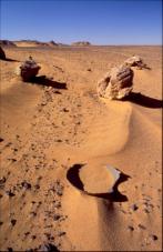
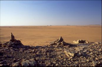
picture 44: keg pot-sherd picture 45: on top of alam hill 1, view to the south
The leg of the road across the plain in the foreground of picture 45 is marked by 3 alamat only. Less than 5km after the plain´s southern fringes (46.7km from Mery) we arrived at SAB. (pictures 46 + 47)
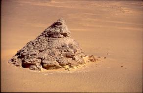
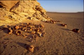
picture 46: SAB-hill picture 47: close-up of jar deposit at southern foot of SAB
At the southern foot of a pyramid shaped hill quite a number of kegs were laid down. They seem to have been deliberately destroyed in a single action which, most probably, took place centuries ago. I counted 40 short necks, representing 40 former kegs. Surprising, this number is “poetically linked” with the Arabic name for a long road, the “Darb el Arbain”. While contemplating about the meaning, which the deposit and the legendary number must have had for the medieval caravan personnel, the execution of the famous order of Ahmed ibn Tulum (see chapter 4g) vividly came into my mind. All what I saw and what I knew fitted together. The TL-date of 880-1320 AD mentioned above (see chapter 4g) points into the direction of an early Islamic origin of the deposit; as well as the fact that we, so far, had been walking on a camel road, on which, a couple kilometres before, we had passed by very old remains of a camel skeleton buried in the sediment.
The vessels at SAB are classified under the name “keg-pot”; a type of pottery which has been produced (with slight variations) from pharaonic Late Period (from around 664-525 BC; see Riemer et al., op. cit., p. 347) up to now. The keg pots of today bear the Arabic name “sega” or “garra”. If one looks at a SAB-keg closely (see picture 48), one will notice the short neck typical for the Islamic period. The above TL-date supports this notion.
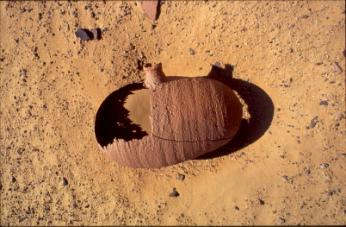
picture 48: SAB keg pot
Note: According to the prevailing classification of Egyptian ceramic only “tall-necked kegs, barrel-shaped bodies” would belong to the pre-Islamic era.
Because of the early Islamic origin of the pottery, the name given to the site is misleading. The Darb Wadai has nothing to do with ancient Egyptian desert routes. Although it is up to the discoverer to decide whether or not the site should be renamed, I would recommend the name of its destroyer as a reference for the place. Thus, the site could be called Ahmed ibn Tulum 1 – dump (AIT-1-dump).
SAB is not marked by an alam. About 500m to the south a stone circle settlement is to be found on flat topped hill of dark sandstone. Six of its hut structures are “fenced in” by a line of rocks.
6.) From SAB to AB2
We spent a day in the beautiful surroundings of SAB. Then we left the marvellous site in confident expectation that the trail would lead us to AB2, of which a picture in Sahara magazine already had revealed similar earthenware.
Traversing three sandy pans oriented north to south and scattered with picturesque sandstone hillocks, we (in 7km distance from SAB) came across a dark hill crowned with an alam. Soon after a caravan route (well marked by alamat and running 145/325 degrees) was crossed, the faint grooves of the Darb Waday and (at 11.2km from SAB) fragments of old camel bones emerged. At 13.6km from SAB we descended into lowlands strewn with tall hills, where we lost the trail. It took a while picking it up again (at the fringes of a further slope, where, 17.5km from SAB, an alam on a hill marks the way (alam hill 3; picture 49). Three camel grooves appeared soon after. (picture 50)
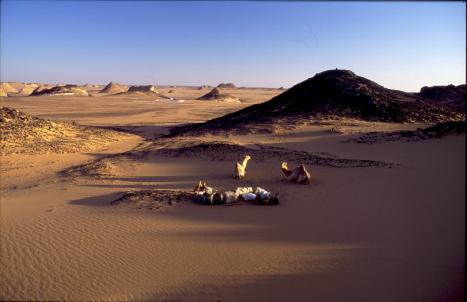
picture 49: alam hill 3
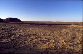
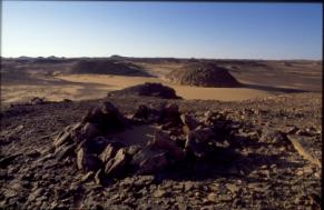
picture 50: grooves of the Darb Wadai picture 51: segment of stone circle settlement on hill in a small depression
Not far from alam hill 3 we traversed a small depression scattered with hillocks. On one of the elevations 8 stone circles had been erected (picture 51). Soon after (a short distance from the downfall of the scarp clearly marked on the Survey of Egypt map) the number of alamat increased, indicating two passes, where the Darb Wadai (27.4 km from SAB) descends into the plain. We crossed the sandy expanse, which is densely covered with car tracks heading towards Abu Ballas, and (at 38.2 km from SAB) arrived at AB2. (pictures 52 + 53) I set up camp in the lee of the pottery hill and fed Amur and Ashan with dried beans & clover, certainly much better feed than the forage for the camels of medieval times. Early in the night an intensely sparkling meteoroid fell from the southern skies changing its colour from green to red and yellow. So bright was its light that the hill on the left in picture 52 loomed against the firmament as if it was a full moon´s night.
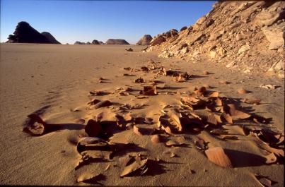
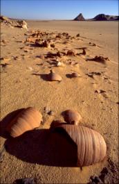
picture 52: AB2-jar deposit, view to the south picture 53: AB2-jar deposit, view to the north
In Sahara magazine Giancarlo Negro et al. have described the vessels at AB2 as “keg pots of the ´garra´ type” (Negro, G., op. cit., p. 126) and, “…considering an average distance of (incredible) 45km/day an easy journey for a caravan of asses…” (ibidem), attributed the site to an Old Kingdom road leading from Dakhla via AB2, DWM, Abu Ballas and ancient ochre quarries (at the western end of the Abu Ballas Scarp) to Kufra oasis in Libya. (ibidem, p. 124) These findings, however, do neither correspond with my observations nor with the prevailing classification of Egyptian ceramic, according to which mainly “tall-necked kegs, barrel-shaped bodies” would belong to the Saite period (664-525 BC; see Riemer et al., op. cit., p. 347), while the vessels shown in pictures 44, 47, 48, 52 and 53 are considered as typical earthenware of the Islamic era. Moreover, almost all road signs and pottery sites discovered on the Darb Wadai up to AB2 (40 waypoints) are in alignment with each other indicating (85km from Mery) a maximum divergence from the mean direction of only 2 degrees. In addition, at AB2 and in its vicinity I found no evidence of an ancient trail pointing to Abu Ballas. There are no Old Kingdom pot-sherds either. But why should ancient Egyptians caravans at all have made a detour of more than 100km, just to please a few desert enthusiasts or scientists of today? For the ones who walked on foot, there was no zigzagging. As proved by the alignment of the TAB, the movement of the ancients across the barren wastes was a straight onwards one. In the light of the above cognitions the term AB2 is misleading, as the dump has neither anything to do with the TBA (6th dynasty activities and later) nor with 4th dynasty ventures (expeditions to DWM). I would, therefore, recommend to call it Ahmed ibn Tulum 2 – dump (AIT-2-dump).
AB2 contains 40 jars identical with those at SAB. Had this number been chosen purposely? If so, what is the meaning of it? I have not touched the vessels, nor have I measured their volume. Each of them had not contained more than 15 litres of water (my estimate), yielding a maximum total storage capacity of around 600 litres. Such quantity would suffice for 15 – 20 camels and a few men (If SAB and AB2 had served as emergency deposits only, a double number of animals and men could have – provisionally - quenched their thirst.) If, however, the precious liquid was strictly reserved for human beings (as it was, most probably, the case), big sized Wadai caravans could be imagined on the trail. The latter reasoning is confirmed by the observation that, at Mery, the Darb Wadai even nowadays can be perceived as a road of more than 400m in width. Thus, from evidence gained so far, it is most likely that the medieval route was intended to be frequented by large caravans. Like at SAB, all jars at AB2 had been deliberately destroyed.
7.) From AB2 to 24 degrees, 10’ latitude
AB2 is situated at the southern edge of an upland area. Continuing in south-southwesterly direction (grooves of the Darb Wadai not being visible in the sand) for ¼ hour, we reached a wide sandy trough almost void of hills, and descended into it. On its southern contour line (12.5km from AB2) an alam had been erected on a low hill. In its vicinity a few alamat are standing out against the ground. Up to our point of return at 24 degrees, 10´ latitude the terrain (with the exception of a big playa area) is completely sand strewn. As special feature we noticed a double line of stones (picture 54) laid out crosswise to our way, alluding to the pharaonic sign for a “road bordered by shrubs” (see Gardiner, A.: Egyptian Grammar. Oxford, 3rd edition, p. 489) Of such layouts Gerhard Rohlfs, the German 19th century desert explorer, reported in his book “Drei Monate in der Libyschen Wüste”. He considered them as relics of the endeavours of the soldiers of Omar Masseri (a Sheikh of the Uled Ali), who supposedly had them filled with feed for camels. (see Bergmann, C., op. cit., p. 400) Later on we passed by a few hunting fences and saw a quite sizable stone circle settlement (consisting of 18 hut-structures and an lookout on a sandstone rock).
In the sandy terrain, which we traversed, the Darb Wadai had completely disappeared. However, once and a while an alam, set on the ground, became visible. As illustrated in picture 55, such way signs usually were of small size. Nonetheless, they led the way. The ones in picture 55, having the air of a trifle, even had been erected in accordance with the line of bearing belonging to our trail.
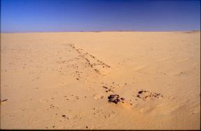
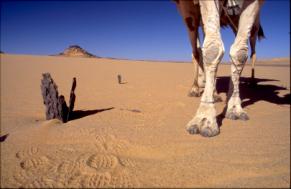
picture 54: Darb Wadai, double stone line picture 55: Darb Wadai, “double alam”
At midday of November 4th we camped in the shade of a white sandstone rock. There was not the slightest freshening breeze. About 10km to the south, across a flat expanse, a dark knoll, almost veiled by haze, rose from the ground. Checking the plain ahead of us with my binoculars I noticed nothing particular. Had we, finally, arrived at an area, where hardly any remains could be expected on a camel road? Had we come to a region, where it is almost inevitable for the wanderer of present days to loose the track? I would have liked to detect a third jar deposit, but we were short of water. We had to return to safety.
Despite such shortcoming the discovery of the Darb Wadai is quite significant, as the existence of the road and its closing is echoed in an Early Islamic period text (see chapter 4g ). If the trail does not alter its direction, it would pass by Bir Terfawi/Bir Sahara in only two days marching distance and, then, would lead to Merga oasis (North-western Sudan). Would such an alignment not imply the existence of a Zerzura being situated right on the Darb Wadai, therefore, rendering it possible to skip replenishing water at Bir Terfawi? Such exciting questions should be dealt with in the near future.
C.) 2nd Leg of the Expedition (11/21 – 12/14/2005)
In the afternoon of 11/21/05 I set out from Gharb el-Mawhub/Dakhla oasis alone with two camels (Amur and Ashan) for the sole reason of verifying Giancarlo Negro´s Old Kingdom Ochre Quarries (COQ) situated at the western end of Harding King´s Wadi Shabura (at the foot of the Abu Ballas Scarp). COQ is located about 170 km to the southwest of DWM. If it would contain 4th dynasty relics, the area of “pharaonic reach” across the Western Desert during the reigns of Cheops and Djedefre would have exceeded all hitherto assumed limits.
We first went south. While passing DWM at fairly close distance, I discovered the Clayton Camp mentioned above (see chapter B.4.a). At this site kitchen equipment and tools customary in early dynastic(?) times are neatly assembled. In the afternoon of the 3rd day of the expedition northern winds ceased and, later, a hot spell from the south developed. The heat rose to (for a wanderer) unbearable temperatures. There was hardly any shade. My water consumption soared to 10.5 litres per day. The camels were in need for a drink every 3 days. The blaze lasted 17 days.
On our way to COQ we passed by a few Clayton sites. At some of them the rings obviously were set up in their state of use. Contrary to the situation at the Clayton Camp discovered in the vicinity of DWM I observed no additional artefacts. Envisioning the environments of a distant past, the notion materialized almost to certainty that Claytons had been used as utensils during periods of food shortage (or for processing complementary nutriment), while sizable clusters of grinding stones (as displayed in Biar Jaqub) could be viewed as indicators of fairly rich harvests.
The night of 23rd –24th November we camped at a high rock of red coloured sandstone, adorned with depictions of “sitting” giraffes (similar to the one shown in picture 26) and other species of the steppe. A stone semicircle erected on a terrace confirmed the perception that the site had served as a hunter´s camp. We turned to the WSW and moved across a flat void. There were no alamat. When we reached undulating ground, we came across clusters of elongated lines of stones. A neighbouring hillock topped with a stone circle had been used as an outlook. In close proximity I noticed petrified bones of a large animal buried in the sediment. Does such an arrangement imply that, once upon a time, the area had been a huge hunting district?
25 km NNW of Abu Ballas we descended into a depression scattered with hillocks, of which quite a number clearly exposed layers of interbedded clays. On playas nearby a few stone tools were found. Approx. 22 km west of Abu Ballas we passed by a 2nd World War air field and entered undulating ground. We descended into Wadi Shabura the following day and set up our midday camp in the shade of a hill which, on its west facing cliff, exhibits rock engravings of steppe animals (among them “sitting” giraffes).
While the playas and yardang fields at the foot of the Abu Ballas Scarp (picture 56) are scarcely littered with stone implements and fragments of petrified bones, neither stone tools nor pot-sherds were found in the vicinity of COQ. (pictures 58 + 59 display close-ups of G. Negro´s first “quarry”) Likewise, there were no clusters of stone circles indicating a 4th dynasty (or any old) mining camp. Although the tremendous heat had a negative effect on my endeavours, I am sure that I did not miss ancient remains at the prominent sites.
Note: The sites are no longer “undisturbed”. About three weeks ahead of my visit people had stopped at COQ (fresh car tracks and foot prints to be seen; Giancarlo Negro´s 1999-4WD tracks still being well visible). If there had been any artefacts not yet discovered by Negro and his colleagues in 1999, such objects might have been collected by the former (unknown) visitors. This possibility remains as uncertainty in my judgement.
In fact, the area (shown in picture 60) is almost bare of artefacts. The region reveals, however, huge deposits of red ochre and of polychromatic sandstone. (picture 57)
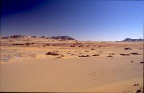
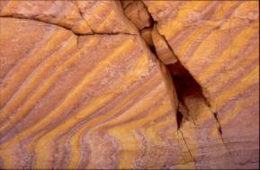
picture 56: yardang field and playa at the
western foot of the Abu Ballas Scarp
picture 57: yellowish sandstone, a variety
of a polychromatic sandstone deposit found in the vicinity of COQ
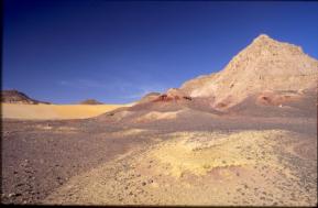
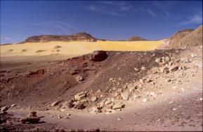
pictures 58 + 59: close-ups of G. Negro´s first “quarry” as exhibited in Pl. H + I of Sahara magazine 2005
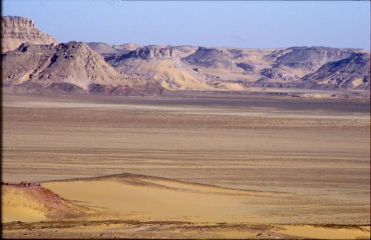
picture 60: Giancarlo Negro´s “Lost Ochre
Quarries of king Cheops and Djedefre”, view from the
south (southern “quarry” in the foreground
on the left; first “quarry” at the foot of the hill in the background)
As seen in picture 60 one of the red ochre sequences stretches along the base of the Abu Ballas Scarp foothills, bending to the north into a wide drainage and then, following its eastern bank, turning south again. The total length of the ochre sequences in the area of the supposed quarries amounts to approx. 7-10 km.
All along COQ one finds similar geomorphologic conditions, parts of which Giancarlo Negro et al. have interpreted as remnants of “…intense exploitation of… (ochre) mineral…(which) definitely (had) involved the work of several tens of men, perhaps hundreds, for a remarkable period of time…Pathways of human origin following the valley and entering the quarry area are still visible.” (Negro et al., op. cit., p. 122) However, I found not the slightest evidence for an anthropogenious nature of any of the peculiarities at COQ mentioned by the authors. On the contrary, the supposed mining activities and pathways were altogether caused by forces of erosion. (see for instance pictures 59 + 60) Eroded hollows and broom clean passages at the foot of rocky slopes are frequently seen at hillocks containing layers of interbedded loams or other “soft” material. If all such places were viewed indiscriminately as the result of human interferences, the desert would have to be envisioned as a place completely crowded with ancient quarries.
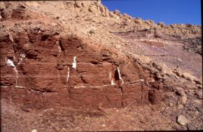
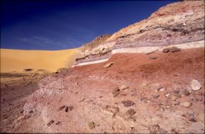
pictures 59 + 60: examples of eroded ochre strata at first quarry
Because of the hot weather I could not investigate the whole area. We left G. Negro´s first “quarry” (after I had taken a farewell photo; see picture 61) in search for an old road, which would connect the “quarries” with the TAB. (Muhattah el Bir, a way station on the TAB, is only 13 km distant from COQ)
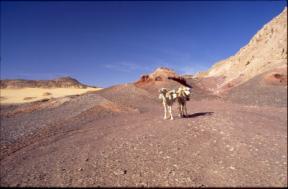
picture 61: Amur and Ashan at G. Negro´s first ochre “quarry”
(for comparison see plate K of Sahara magazine 2005)
We found a couple of alamat. They were set up close to a great number of old car tracks in a sandy expanse. Apparently they had been erected by tourists or, long ago, by the British during World War 2.
For that reason I hesitated to “connect” them with Muhattah el Bir on the TAB.
Note: If anybody in ancient times would have had travelled to the ochre sites, he would (like on the TAB) most certainly have avoided sandy stretches, staying as long as possible on the (“moist”) playas, which extend along the foot of the Abu Ballas Scarp. There he would have run into forage for his donkeys with higher probability than in the sands.
Years ago I discovered a site about 25 km southwest of Abu Ballas containing Roman period pot-sherds. The place is situated at the northern foot of a hillock, only 200 m apart from a long term camp of the Cologne University project. Although it would fit neatly into a framework of dreams, I hesitate to “connect” this site and the few alamat mentioned above with the “quarries”, with Muhattah el Bir, and with Abu Ballas for the mere sake of “establishing” a route, which probably had not existed. The Roman pottery had been dumped there recently, the sherds being arranged like in children´s play. (At times, there was a boy along with the Cologne team. Thus, presumably these pot-sherds never were in an “in situ” position.) This alone makes the site unsuitable for any proof.
D.) Discovery of a Forerunner of the TAB
I also focussed my attention on a side track of the TAB, along which we found two pottery sites as well as several Muhattahs (in about 15km distance from each other) covered by sand. To me the pot-sherds looked very old. They should be analysed by a specialist. In my opinion the trail is a forerunner of the TAB. It had been given up before the TAB proper was established, because the pharaonic scouts arrived at a large & empty expanse which they, most probably, found unsuitable to cross with their donkeys. As traced so far, the eastern end of the road is well marked by alamat, while further to the west such efforts have ceased. More efforts to verify the whole length of the trail are necessary in order to procure a more detailed picture of the ancient road, which passes by COQ in about a day´s marching distance.
E.) Supplement: Note on Islamic Relics on the Tariq Abu Ballas (TAB) and on the Story of the City of Brass in “The Thousand and One Nights”
Time and again during the past 24 years when roaming the impenetrable expanses of the Western Desert with my camels, I found myself wrapped skipping and galloping through old reports and anecdotes narrating desert adventures. Such occupation of the mind not only embellished the hours of lonely, monotonous walking but also opened an opportunity to search for hidden meaning in what is generally considered to be mere fairy tale. Quite a few of these texts, most of them of Egyptian origin, feature treasure hunts; among them the “Story of the City of Brass” in “The Thousand and One Nights”.
In the “City of Brass”, the caliph in Damascus, Abd al-Malik ibn Marwan, had sent out an expedition in search of copper flasks stopped with lead and sealed with the signet of Solomon, bottles in which jinns and devils had been imprisoned. According to Burton´s translation, Shaykh Abd al-Samad ibn Abd al-Kuddus al-Samudi, the guide of the expedition, on being questioned about the way to the City of Brass, replied to Musa ibn Nusayr, governor of Ifriqiya (703-714 A.D.), who, at the time of the interview, resided in Upper Egypt: “… know O Emir, that the road thither is long and difficult and the ways few….It is a journey of two years and some months going and the like returning, and the way is full of hardships …” After an exchange of words the guide disclosed privily: “O Emir, take with thee a thousand camels laden with victual and store of gugglets (long necked water vessels; see chapters B4g + B5 for dating short and tall-necked keg-pots)…. On our way is the desert of Kayrwan or Cyrene, the which is a vast wold four days´ journey long, and lacketh water, nor therein doth sound of voice ever sound nor is soul at any time to be seen. Moreover, there bloweth the Simoon and other hot winds called Al-Juwayb, which dry up the water-skins; but if the water be in gugglets, no harm can come to it.” “Right”, said Musa and sending to Alexandria, let bring thence great plenty of gugglets. Then he took with him his Wazir and two thousand cavalry clad in mail cap-a-pie and set out.” (1)
Comparing Burton´s translation with the 2nd Calcutta edition of the “Nights” and supplementing it with Breslau edition quotes, E. Littmann enlarges the size of Musa´s caravan: 1.000 camels carrying water, 1.000 camels laden with provisions and earthen jars; the expedition heading for the desert of Kayrwan, an expanse 40 days wide and almost void of water. (2) The explanation for the need to take jars along, in this case as well as in G. Weil´s translation, (3) remains unchanged. G. Weil, who bases his opus of the “Nights” on the 1st Bulak as well as on the Breslau edition and, in parts, utilizes a Gotha manuscript, arrives at a caravan consisting of 1.000 camels for carrying water, another 1.000 for carrying provisions and a further 1.000 for carrying earthen jars; a volume required by Abd al-Kaddus for, inter alia, a 40 days crossing of the xeric Kayrwan wastelands. (4) It is not clear from where exactly the caravan of the treasure hunters started, where the enterprise found it´s end, and if advance and return route were identical. In all but Weil´s version, in which Musa ibn Nusayr returned to Baghdad, the latter delivered the treasures of the hunt to Damascus.
Whether these differences in the description of Musa´s caravan and it´s circumstances of travel are due to flaws in transcription, to subtleties of translation or are owed to contradictory source material, respectively different variants of hearsay, one is apt to conclude that a sizable amount of water jars was needed in order to traverse an alien arid expanse of considerable dimensions, the latter being situated in the region south of present day Tunisia, if not “Kayrwan Desert” was meant to mean the whole of the Sahara.
The above textual evidence leaves open to speculation, if water, needed for the return desert passage, was filled in jars and deposited at way stations, or if (while on the desert leg of the route) the precious liquid was carried along exclusively in gugglets. Does, however, in G. Weil´s translation the term “aufbewahrt” (stored) not indicate the installation of water dumps? (5) Let´s leave the answer to this question to those with profound knowledge of early Arabic literature.
The water jar passage in the “City of Brass” recalls an ancient practise. According to Herodus´ report from Egypt, empty wine amphorae had to be collected from every village and town. (6) The vessels were needed to maintain a system of water reserves along the arid sections of the trade routes to Palestine and Syria. After Cambyses had conquered Egypt, the Persians adopted this custom, which facilitated the upkeep of a line of communication between their new colony and the supreme authority in their homeland. However, the 1917 discovery of Abu Ballas pottery hill 180 km southwest of Dakhla oasis; a site, which contained several hundred jars from late Old Kingdom times, demonstrates that the utilization of earthenware for establishing water deposits in the Egyptian desert was customary long before the advance of the Persians. Are, therefore, large accumulations of time-worn pottery such as at Abu Ballas (7) an allusion, that modes of pharaonic desert travel are, to a certain extent, “fossilized” in the “City of Brass”? Or is it, on the other hand, conceivable, that remote places like Abu Ballas had been visited by Arab merchants and camel drivers on their way to far away destinations; places, of which they reported after return to their homes? So that scribes, chroniclers and tellers of tales, quoting from hearsay, could incorporate the existence of such sites into speeches and texts for the amusement of “ignorant” townsfolk? Although distorted into the vague and fabulous, there must be a grain of truth in the “Story of the City of Brass”.
Musa ibn Nusayr´s treasure hunt is set in the time of the Umayyad caliph Abd al-Malik ibn Marwan (685-705 A.D.). First versions of “The Nights” date to the 8th century. No manuscripts from that time have survived. A Late Fatimide period edition (from around 1.100 – 1.170 A.D.) was very popular in Egypt. It is not clear, whether or not the “City of Brass” was incorporated in this body of texts. Not earlier than 1.500 A.D. one is on safe ground, when forming an opinion on genesis and chronology of Alf Laila wa Laila. (8) The manuscripts referred to in this paper display language, manners and customs of the Egyptians of the time of the last Mameluk sultans. These features prevail even in stories, in which foreign countries are used as a stage for the tales. The writing as a whole is impressively imbued by a vital belief in Islam.
The fairy-tale places the City of Brass in the westernmost reaches. However, our view towards sunset is diverted by the existence of a site in south-western Arabia bearing the same name (Medinat en-Nahas). It received it´s nomen because of the many brass artefacts found there. In addition, there are the copper mines of Hofrat en-Nahas, exploited since mediaeval times and situated on the upper reaches of the Bahr el-Arab, 450 km south-southwest of El Fasher in The Sudan. Moreover, at Igbo-Ukwu, Niger, hundreds of fine brass castings were found in excavations and tentatively dated to the ninth century. It is assumed that the mines, which Ibn Battuta had seen in 1354 A.D. at Takedda (9), the largest Tuareg town situated east of Gao, could have been the source of the copper and lead used to make the bronzes.
Littmann hypothesizes that the “City of Brass” may be related to travel accounts to Northwest Africa. (10) Examining the body of literature on Arab geography of West Africa and of early Arab travellers to the region, one comes across Al-Fazari, who was the first to mention “Ghana, the land of gold” at the end of the 8th century. (11) Writing in 891 A.D., another chronicler, Al-Yaqubi, who resided in Khorasan, Persia (after 873 A.D. in Egypt), and who visited the Maghrib, acquaints us with a scenario of merchants from Khorasan, Basra and Kufa lodging in Zawila oasis, which, at the time, was a well established slave trading centre. (12) In the 950s A.D. Ibn-Hawqal claimed to have crossed the Sahara and to have visited Awdaghost. His assertation of having seen a bill of debt written in Awdaghost in the sum of 42,000 dinars is generally considered as confirmation of his journey. Ibn-Hawqal also mentions the abandonment of a caravan route, which linked Egypt and Ghana, over al-Wahat (the oases), in favour of a new western Trans-Saharan route leading from Sijilmasa to the Sudan. (13) After the closing of the “tariq al-Wahat Misr” (TWM) the Muslim traders from Iraq left Zawila and began to flock to Sijilmasa.
The TWM had been described earlier (around 900 A.D.) by Ibn al-Faqih, Iranian scholar and geographer: “When you cross the frontiers of Ghana going to Egypt you reach a nation of the Negroes called Kawka (Gao), than another nation called Maranda, then one called Marawa, then (you reach) Wahat Misr (the oases of Egypt) in a place called Malsana.” (14) Although commerce on this route was severely affected by the above mentioned shift in caravan trade, we know from Benjamin of Tudela´s itinerary, that the road had still been in use during the 1160s. (15) The Jewish rabbi, dramatizing the perils of desert crossing, noted in Upper Egypt, that the leg of the journey from Zawila to the Egyptian oases took 50 days. “Those which escape (the mountains of sand) carry iron, copper, different sorts of fruits, pulse and salt; gold and precious stones…” (16) Whereas Rabbi Benjamin viewed the TWM from it´s eastern end, Ibn Battuta, being at it´s western terminal 200 years later, has no knowledge of it. Battuta, who travelled from Sijilmasa southward across the Sahara to the capital of Mali and continued to Timbuktu, Gao and Takedda, arrived at the wells of In Azawa (modern In Azooua) in October 1353, “at which the Ghat road, leading to Egypt, and the Tawat road divide.” (17) His caravan followed the latter to Fes. Had the TWM still been frequented, Battuta would, most certainly, have handed down to us some information gathered either in the capital of Mali, where he stayed in the quarter of the whites, obviously native Egyptians settling amongst them, (18) on markets in Gao and Takedda or at the wells of In Azawa. Nevertheless, it should be recalled that Battuta also reported of copper mines in the vicinity of Takedda, which, later, Heinrich Barth and others failed to find. Because of such misfortune Battuta´s perception of the diggings as well as his account on copper exports from Takedda to a region north of present day Sokoto, to Kanem and to Wadai (19) have been dismissed as an inversion of memory by some authorities. As, over the centuries, the Takedda mines have dissolved into nothing, so the TWM has faded out of existence, the “City of Brass” being one of the few sources of literature, which would recall the al-Wahat Misr ventures of the past for a large audience.
“There betided us seven successive years of drought, wherein no drop of rain fell on us from the skies and no green thing sprouted for us on the face of the earth. So we ate what was with us of victual, then we fell upon the cattle and devoured them, until nothing was left. Thereupon I let bring my treasures and meted them with measures and sent out trusty men to buy food. They circuited all the lands in quest thereof and left no city unsought, but found it not to be bought and returned to us with the treasure after a long absence; and gave us to know that they could not succeed in bartering fine pearls for poor wheat, bushel for bushel, weight for weight. So, when we despaired of succour, we displayed all our riches and things of price and, shutting the gates of the city and its strong places, resigned ourselves to the deme of our Lord and committed the case to our King. Then we all died, as thou seest us, and left what we had builded and all we had hoarded. This, then, is our story, and after the substance naught abideth but the trace.” (20) Did these words, engraved in silver characters in a tablet of gold, remind Musa and his fellow treasure hunters of a famine, that had refrained all those dwelling in distant, impenetrable labyrinths of rock and sand from digging for riches and from trading diminishing quantities of iron, copper, gold and precious stones across the waterless expanses of the Sahara - to reach, via the TWM, the fertile pastures of the Nile valley?
Saharan trade began as a by-product of essential exchanges of mineral salts for victuals. Such trade expanded over thousands of miles. The cereals received in exchange for salts allowed the survival of large desert communities. Later, the introduction of the camel in North Africa led to an increase of trade on existing routes and promoted the setting up of many new routes. Annual fairs grew up at certain inland oases and at crossroads towns, where merchants from both north and south of the Sahara had settled. The significance of roads and their termini rose and fell according to needs, environmental conditions and political interference. Besides slaves common place commodities like gums, skins and grain, long-term staples in the trade-metals such as iron bars, zinc, silver but most important of all copper, brass and gold were bought and sold. During the 8th and 9th centuries the Ibadite schismatics pioneered in long-distance trade from their northern kingdoms Sijilmasa, Tahert and Fessan (Zawila). (21)
As a complement to north-south Trans-Saharan trade routes a number of transcontinental (east-west) routes had developed. One of them, the TWM, supposedly originated from termini on the Nile such as Asyut, Sohag, Girga, Farshut, Rizakat and Esna and then proceeded via the oases Kharga (22) and Dakhla (23) to the west. Memories of the exchange of goods and people on this route are echoed in the dialect of the oases, in which a formerly Berber-speaking segment of the population from the mountains of the Maghreb and the Sahara, either on the occasion of the Arab conquest, of migration and pilgrimage or of trade had left its traces. (24)
This was the information available at the time when I set out with my camels in an attempt to turn the ancient legend of the “City of Brass” into reality.
Almost at the beginning of my reconnaissance of the desert west of Dakhla oasis I came across the lengthy route of which Beadnell reports: “An old caravan road can be seen running west from Mut… the direction of which inclines one to believe that it was formerly possible to cross the intervening desert to the distant oasis of Kufra.” (25) The winding tracks of this road, in parts still to be seen, and a few scattered remains of potsherds found on it affirmed me in my conviction that, despite the impenetrable dunes which had caused the G. Rohlfs 1873/74 - expedition to give up intentions of reaching Kufra and to acquiesce with Siwa as a second choice-destination, there once had been considerable traffic traversing the Great Libyan Sand Sea via Wadi el Gubba to the former Sanusiyya stronghold. Further investigations revealed that more than a dozen additional roads head into the Regenfeld Dune, namely between a point about 20 km north of Regenfeld and El-Burg. (26) Some of these tracks appear to follow a strictly western direction while others head more towards the southwest. (27) Whether or not the majority of these trails finally would emerge in the vicinity of Kufra, can only be learned by tracing them to their final destination. The potsherds seen on road fragments and a small number of well preserved jars detected at two way-stations (muhattahs) (picture 62) have not yet been dated. While some of the sherds appear to belong to the early Islamic period, the jars lead one to suppose a Sanusiyya era provenance.
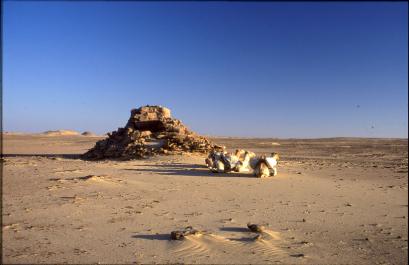
picture 62: Islamic Muhattah east north-east of Regenfeld containing a vessel of, supposedly, Sanusiyya era provenance
The above routes do not intersect with the Tariq Abu Ballas (TAB). They have, contrary to the suggestion of some authorities, nothing to do with it. (28) Neither the TAB nor a side track of it runs to Kufra. I traced the ancient pharaonic trail between February 1999 and February 2003, when a 440 kilometre long stretch of desert between Balat and the south-western fringes of the Gilf Kebir was explored with the help of my camels. (29) During the survey quite a few segments of the old road and more than a thousand road-signs (alamat) indicating it were found. In addition to the 1917 discoveries at Pottery Hill hundreds of water jars and innumerable potsherds dating from 6th dynasty to the Roman period came to light. The earthenware is concentrated in more than 30 muhattahs and sherd-sites. While most jars carry possession marks, one vessel found at Muhattah el Homaren (30) is adorned with the image of two resting donkeys, a mark which had been incised before firing. Such practise could indicate that the content of the vessel was meant for storing fodder (e.g. barley or beans) for the donkeys, the beasts of burden in pharaonic times.
The ABT runs due southwest. It descends from the Gilf Kebir plateau at Wadi El Akhdar, where a water source used by the ancient caravans most certainly had existed. The site has not yet been found. As far as evidence goes, the trail would then head for “Rough plateau” and, at a greater distance, for Gebel Arkenu or Gebel Uweinat. (31) Further exploration of the TAB would have to begin at the south-western foot of the Gilf Kebir, where a minefield at Wadi El Firag and, later, several others in the vicinity of Peter and Paul form hazardous obstacles. Pictures 63 and 64 exhibit the fruits of four season´s effort: my expedition maps secured with sand, the substance which has eroded and veiled so many ancient artefacts, obscuring the precise history of the TAB and replacing it with legends.
picture 63: expedition map; TAB-road segment “Mery to southwest of Abu Ballas
picture 64: expedition map; TAB-road
segment “Southwest of Abu Ballas to Gilf Kebir”
In order to insure undisturbed further examinations the south-westernmost leg
of
the TAB has been left deliberately
vague.
Note: In order to put an end to the confusion produced by scientific publications (such as Sahara Magazine) about the course of the TAB and about the position of DWM and Biar Jaqub I found it appropriate to present three of my expedition maps to the public.
In November 2000 I had discovered an ancient muhattah off the TAB. The road station situated about 2.5 kilometres north of Muhattah Arba´ Mafariq contained a small amount of Abu Ballas-type pottery and a Clayton ring. More than three years later, accompanied by Chalil, my Egyptian aid, I picked up faint grooves leading from this muhattah to the southwest. When we arrived at two low flat-topped rock outcrops (“mastaba-rocks”), the top of one of them being adorned with sandals, a human figure, two animals crudely arranged in a circle and some indefinable symbolism, it became evident that an ancient road running parallel to the TAB had been found. Whether this hitherto unknown trail combines with the TAB at certain muhattahs or whether it is a fully autonomous road, has yet to be ascertained. For identification purposes I named the road-segment TAB-2. To make the wonder complete two additional caravan routes, (32) probably dating to the Islamic period, run parallel to the TAB. If the TAB-2 traverses the desert north of the TAB, the two “Islamic routes” do so about a kilometre to the south.
One can only wonder about the volume of hitherto unknown ancient traffic having crossed the vast void between Dakhla Oasis and the Gilf Kebir/Uweinat mountain area. Most probably, these tracks continue to Ennedi and to the Lake Tschad Basin. A few alamat similar to the larger road signs on the TAB were seen southwest of Gebel Uweinat in north-eastern Tschad. Concerning the movements of donkey caravans in ancient times the findings reveal, that an organization of considerable size had been in charge of providing supplies for men and beasts of burden.
Until recently it had remained a mystery how the ancients managed to refill hundreds of water jars distributed along the TAB over great distances. To solve the riddle, the idea of a “three-donkey-supply system” has been put forward. (33) According to this proposal a caravan of three (thirty, three hundred etc.) donkeys left Dakhla for the southwest. Arriving at the first station one donkey-load was dumped. The unburdened beast returned to Dakhla, while the two others continued their march. On reaching the next station the second donkey left its cargo and retreated to the oasis. For his safe return it consumed some water and provisions stored at the first station. The third donkey advanced to the third station and left its load there. On his return to Dakhla it used up parts of the supplies dumped at the second and at the first station. The authors of this theory believe that such a procedure could have been continued limitlessly, thereby promoting the set-up of a line of depots across elongated stretches of the waterless Libyan Desert.
As well considered as this model appears, it does not reflect the distribution of jars discovered in the field. Only two main deposits on the TAB do exist: Abu Ballas and Muhattah Jaqub (MJ), the latter being situated almost half way between the former and Dakhla Oasis. Any other dump consists of considerably less jars and potsherds. Moreover, southwest of Abu Ballas the set-up of deposits becomes erratic. A sequent supply of water from a single source originating in Dakhla would call for a distribution of jars much different from what has been discerned in situ.
On a camel trip in winter 2003 a more suitable explanation for the ancient water supply scheme was found. Accompanied by Johannes Kieninger my caravan came across an old trail leading from Muhattah Jaqub due north. In 11.9 km distance from MJ we arrived at the foot of a conical hill, where scattered remains of time-worn Abu Ballas-type potsherds as well as fragments of eroded Sheikh Muftah earthenware account for an ancient way station (Muhattah Ikepi; MI). The trail, segments of it still visible, is marked by a few alamat and leads to Wilkinson´s 2nd Zerzura. Such a discovery categorically points to a lateral supply of water for MJ. Accordingly, I named the path “Tariq el ma´a – road of the water” (TM). The expedition map of winter 2003/4 (picture 65) reveals TM as a red vertical line to the left of a cluster of survey routes representing Wilkinson´s 2nd Zerzura.
In 1835 Sir Gardner Wilkinson published two quotes from native narrative about the whereabouts of a so called Zerzoora (a “lost” oasis). The second quote runs as follows: “...Zerzoora is only two or three days due west from Dakhleh, beyond which is another wadee; then a second abounding in cattle; then Gebabo and Tazerbo; and beyond these is Wadee Rebeena; Gebabo is inhabited by two tribes of blacks, the Simertayn and Ergezayn.” (34) While, in 1932-1934, Count Ladislaus Almasy and three adventurous British citizens (Sir Robert Clayton East Clayton, Hubert G. Penderel and Patrick Clayton) had discovered Wilkinson´s 1st Zerzura (35) about “…six days west of the road from el Hez to Farafra” (36) in the north-western section of the Gilf Kebir-Plateau (Wadi Abd el Malik, Wadi Hamra, Wadi Talh), I discovered Wilkinson´s 2nd Zerzura in spring 1999. I named it Biar Jaqub (BJ). This palaeoasis, which represents the biggest rock-art archive between Dakhla Oasis and the Gilf Kebir, comprises an area of 40 square kilometres. (37) At its northern end I had found “Djedefre´s Watermountain” (DWM),
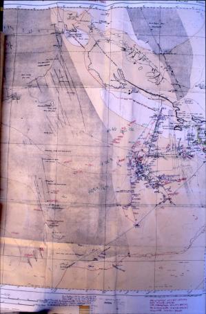
picture 65: expedition map of winter 2003/4
with TAB-segment, Wilkinson´s
2nd Zerzura/Biar Jaqub(BJ), DWM (marked as WDR) and TM
a 4th dynasty mining camp. (38) Two hieroglyphic inscriptions next to the cartouches of Cheops and of Djedefre explain the purpose of several expeditions to the area. (39) The texts correspond perfectly with recently detected 4th dynasty seals and leather bags containing ferric oxide. The discovery was made by Egyptian archaeologists in the region of the Giza pyramids. A number of ostraca belonging to the find reveal that the expedition, which consisted of more than 400 men, had been sent to the desert district in search of red paint to decorate the pyramids. (40)
At DWM an enigmatic rock drawing composed of water-mountain symbols (representing wells) and a number of irrigated fields, two of them connected with a water-source, catches the eye. Another irrigated field belonging to the same drawing is linked to a pharaonic water-sign. In addition, two pharaonic names common during Middle and New Kingdom times occur in the rock drawing´s lower part. (41) On the basis of a photograph Prof. Verner tentatively translated them as Sa-Wadjet and Ikepi. Assuming that all items of the rock drawing could be viewed as a homogeneous entirety, the arrangement of wells, irrigation canals, fields and names could qualify as evidence of an early agricultural report, as a map or, even, as a register of land ownership.
The area, which contains a remarkable number of Sheikh Muftah pottery sites, still awaits thorough archaeological examination. Barring future discoveries proving otherwise, the rock drawings at DWM and in BJ reveal that water was available in both places not only during the Neolithic wet phase but also in ancient times; a road (TM) to Muhattah Jaqub as well as a way station (MI) had existed, any or all of which provides compelling evidence that the precious liquid stored in jars at MJ was provided by means of a lateral supply of water, that is: water had been carried from Biar Jaqub to the TAB.
When viewed from the east, DWM bears some resemblance to Nabataean rock-palaces and -tombs at Petra. Local Bedouins, who have followed the archaeologists´ car tracks to the pharaonic mining camp, refer to the site as “ma´bad” (temple). Such denomination correlates with information about a stone temple conveyed to Harding King in 1910. This edifice, two natives of Dakhla had told the British explorer, could be found in “…eighteen hours´ journey to the west of the village of Gedida…”. (42) One of the men even “… had ridden out and found this place, so probably it exists.” (43) Harding King, who had noticed quite a few ancient road segments and alamat on his wanderings in the “…belad esh Shaytan, or `Satan´s country´, as the natives call this part of the desert…”, (44) finally qualified the information as allusions of people who were “…clearly badly bitten with the treasure-seeking mania.” (45) Astonishing how accurate the information was! May this instance as well as Wilkinson´s aforementioned quotes remind the reader that oral tradition concerning treasures, old trails and lost oases, including the fragments of “hard facts” incorporated in the “Story of the City of Brass”, deserve a serious appraisal.
The TAB passes by a few conspicuous columns of black sandstone none of them taller than a man´s height. These pillars and a “pair of demons” (Or are they lovers?) sculptured out of a single rock by erosion (picture 66) reminded me unintentionally of passages in the “City of Brass”. I had detected coarse Arabic graffiti (see chapter B1, picture 1) next to the Middle Kingdom inscription at Mery´s rock. (46) This find encouraged me to search for archaeological remains belonging to the Islamic period. When, shortly after, I noticed a few pottery fragments from early Islamic times at Muhattah el Askeri and at Muhattah Amphorae, my interest in “constructing a reality” for the “City of Brass” arose. The endeavour was rewarded at MJ, where I located an Old Kingdom potsherd inscribed with a short sequence of Arabic characters.(picture 67) This text and another one found on a sandstone slab, hidden in an alam on the top of MJ, (picture 68) have been identified by Janine el-Saghir as variants of the Kufic script. (47)
Kufic script dominated Arab writing during the first three centuries of the Islamic period (7th – 9th century A.D.). As the oldest calligraphic form of the various Arabic scripts it was mainly used for recordings of the Qur´an. Graffiti produced in Kufic style were found in their thousands etched on rocks throughout the central Islamic lands. They are also numerous in Egypt. Contrary to such abundance there are almost no studies which consider what these graffiti can tell us, who wrote them and why. Due to this neglect the two MJ-ostraca still await translation and a profound
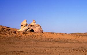
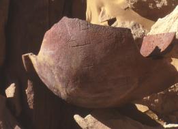
picture 66: spectacle of eroded rock beside the TAB picture 67: Kufic script on Old Kingdom potsherd
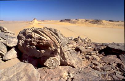
picture 68: sandstone ostracon found on top of Muhattah Jacub-hill
interpretation.
What can be derived from the sheer existence of Kufic texts at MJ, is that the TAB obviously bears traces of communication dating to the period shortly after the collapse of Byzantine rule in Egypt. Furthermore, the abundance of ancient relics found on the TAB adds weight to the hypothesis, that neither in pharaonic times nor in the Islamic era had the Western Desert been perceived as the fearful void per se. Intermediaries and Bedouins continued to cross vast stretches bare of vegetation with their caravans. By 200 A.D. camels had replaced donkeys as beast of burden. The new mode of transport led people to travel more widely. While desertification accelerated merchants from West Africa became accustomed to trade with Egypt and the countries further east by utilizing transcontinental desert routes. Along these lines of communication not only produce but also news and stories were forwarded. Some of these reports might have related remnants of fear which had afflicted the travellers. Others might have transmitted news about immeasurable wealth witnessed in places like Ghana or Mali, while subsequent accounts described nothing but the vanishing of the latter. The “City of Brass” contains all of it: memories of hope and decline, of dangers, of greed and of lost fortunes, of aspiration and sacrifice; and of faithful quest for a belief in God.
As far as evidence goes, some of the long-distance routes which headed from Dakhla oasis due west, touch the Biar Jaqub area while others run north of the palaeoasis. Whereas these roads leave barely a doubt about their intermediate destination (Kufra), the finds of early Arabic items on the TAB are much harder to interpret. As scarce as these remains are, they do account for movements in early Arabic times directed towards the Uweinat mountain area and perhaps further, via Tekro, Agades and Gao, to the West African “lands of gold”. These adventurous enterprises might be reflected in the “City of Brass”.
When describing the route from Awjilah to the Egyptian oases, el-Bakri narrates an expedition of Mocreb ibn Madi to the mysterious oasis of Sobru. After losing its way Mocreb´s caravan arrived at an ancient building, the walls of which consisted of red copper cubes. The treasure hunters spared no time loading the valuables onto their beasts of burden. Notably, on their way back Kharga oasis was passed. (48) Admitting a consequent possibility of anachronism passages of el-Bakri´s “Sobru adventure” could have well served as a herald for the “City of Brass”, a tale in which “memories of decline” of a former golden age are petrified.
Explorations in the desert west and southwest of Dakhla oasis carried out between 1999 and 2004 have led to the discoveries of the TAB, of DWM and of BJ. In the context of antiquity´s limited documentary corpus these unveilings came as a surprise. They excited a number of experts and raised a lot of questions, amongst them: do the three finds belong together? The detection of TM and MI lends strength to the conjecture that the answer could be a positive one. It is my conviction that the latter two finds round up my research concerning TAB, DWM and BJ to a single big discovery.
As a by-product of the endeavour a few items dating to the early Islamic period were brought to light. It is plain to me, that in these artefacts the fairytale of the “City of Brass” materializes. ´Are those few potsherds and inscriptions worth the effort?´, one might inquire. To the ones who are involved in moving and sieving thousands of tons of rubble, dust and sand; to those who solve complicated riddles in the field of lost meaning and in the realm of strewn artefacts, the answer is clear: even the scarcest and most trivial remains of the past will help reconstruct a panorama which, long ago, was erased by the passage of time.
A.) Gathering of colocynth pips and food preparation
1. Adapting to hunger: “famine plant foods”
“Over large parts of Africa people once obtained their basic subsistence from wild grasses. In certain places the practise still continues – especially in drought years. One survey records more than 60 grass species known to be sources of food grains.” (Bord on Science and Technology for International Development. National Research Council. Washington, D.C.: Lost crops of Africa. Chapter 14, Wild Grains, p. 251) “Many of the stone implements found at archaeological sites throughout the Sahara were probably created for harvesting wild grass seeds.” (Ibidem) “In modern times these wild grains have been neglected and even much maligned. Various writers repeatedly refer to them as “famine foods” However, “..all evidence suggests that the grains were a delicacy… Despite its former prestige and ancient heritage, the wild-grain harvest has been declining for a century or more. A major reason for the decline is that the once vast stands of grasses are much reduced.”(Ibidem, p. 253) “The nutritional value of wild grass seeds has seldom been studied in detail,… some may be unusually high in food energy.” (Ibidem, p. 257) “Along the southern fringes of the Sahara the primary wild cereal is kram-kram (Haskanit; Cenchrus biflorus). This annual grass builds massive stands over thousands of hectares of sand plains an stabilized dunes. In earlier times, it was the dominant cereal of both the Sahel and the borderland between the Sahel and the Sahara. In those days it was a more important food than pearl millet, and its grains were milled into flour and made into porridge on a vast scale.” (Ibidem, p. 262) As a source of forage the plant “..persists in a dry but palatable state until the next rainy period.” (Ibidem, p. 266) “Many of the Tawarek, from Bornu as far as Timbuktu”, wrote Heinrich Barth in the mid-1800s, “subsist more or less upon its seeds.” When mature, the burs fall to the sand in great quantities, often clinging together in giant masses that roll along with the wind, growing as they go. People sweep them up with bunches of straw or with giant “combs”. They throw them into a wooden mortar and pound and winnow away the troublesome spines, leaving behind the white, flavorful seeds.” (Ibidem)
2. Handal pips as wild plant food
In Mortimore´s list of 68 plants used in times of famine in the northern Kano State (Nigeria) colocynthus vulgaris Schrader (Syn. Citrullus colocynthis (Linn) Schrader), the bitter melon, is listed in 53th place (no record of use in the famine of 1972-74). (Mortimore, M.: Adapting to drought. Farmers, Famines and desertification in West Africa. Cambridge 1989, table 3.12; see also Bernus, E.: Famines et secheresse chez les Touaregs Saheliens: les nourritures de substitution. Africa. Journal of the International African Institute. Vol. 50, No. 1, p. 5)
Dalziel states that colocynth „..kernels are not usually eaten, but in scarcity in the E. Sudan they may be so used after long boiling to remove any suspected drastic quality. Also the Tuareg are said to eat the seeds after cooking and roasting.” (Dalziel, J. M.: The useful plants of West Tropical Africa. London. 1937, pp. 53, 54) “The leaves and stems are eaten by goats and wild game, but the fruits only by donkeys.” (Ibidem, p. 53)
It seems to be a common practise around the world that poisonous substances in food plants are extracted by washing out or by exposing their nutritious components to heat. In case of the Brazilian Maniok the South American Indians get rid of the hydrocyanic acid by sqeezing out and then roasting the bulb after it has been milled.
In 1869 Gustav Nachtigal reported from Murzuq (Libya) that the diet of the poorer inhabitants of the town consisted “not insignificantly of colocynth pips, a more nourishing food than the berries of Zizyphus spina Christi, of Zizyphus Lotus and of the fruits of the dome palm (Hyphaene thebaica).“ The kernels were prepared for consumption by a laborious process. (Nachtigal, G.: Sahara und Sudan. Vol. 1, Berlin 1879, pp. 128,129), of which he reveals no details. It is not clear, whether or not the procedure, to which he, later, refers to while traversing the Tibesti, is of the same nature: “Der Process, durch den die Kerne geniessbar gemacht werden, ist ein sehr complicirter. Man erntet sie im Sommer, trocknet sie gehörig, thut sie in starke Säcke und befreit sie durch Treten von einem Theile ihrer Schalen und sondert sie durch Worfeln von diesen. Alsdann mischt man sie mit der Asche von Kamelmist, bearbeitet das Gemisch zwischen glatten Steinen, wie man sie zum Mahlen des Getreides benutzt, beraubt sie dadurch eines Theils ihrer Bitterkeit und drastischen Eigenschaft und entfernt gleichzeitig den letzten Rest der Schalen. Nachdem man sie wieder geworfelt hat, kocht man sie mit den Laubspitzen des Etel-Busches, wässert sie kalt ein und wiederholt diese Procedur, bis jede Spur von Bitterkeit verschwunden ist. Endlich trocknet man sie in der Sonne und hat ein angenehmes und in Pulverform sehr geeignetes Nahrungsmittel gewonnen, zu dem man gerne Datteln in denselben Zustand fügt und das in der Oekonomie der Bewohner Tibesti´s nicht ohne Wichtigkeit ist und für sehr nahrhaft gilt.“ (Ibidem, pp.249,250; my translation: Refining the kernels is a complicated process. After handal is harvested and dried in summer, the fruits are filled in sacks and crushed by trampling. Then the kernels are seperated by winnowing. Thereafter, the pips are mixed with ashes of camel dung, the “blend” being ground with grinding stones(!), such procedure taking away parts of the bitterness and of the purgative potential of the kernels. The product is winnowed once more and then, after adding leaves of the Etel-bush, boiled and watered until the last trace of bitterness has been removed. Finally, after sundrying, a refined flour is obtained, to which date flour is readily added. Such diet is very nourishing and of no insignificance for the domestic economy of the inhabitants of the Tibesti. See also: Le Coeur, C.: Dictionnaire Ethnographique Teda. Paris 1950, pp.56,57) Nevertheless, Nachtigal´s handal pip refining indicates a considerable waste of water. How would such a process be performed, if the precious liquid had been a scarce resource?
G.W. Murray notes that “though the colocynth is incredibly bitter, its seeds are sometimes ground and eaten in times of famine… The Beja distil an oil from colocynth seeds, which is also used for tanning waterskins. They build a miniature “hut” of loose stones with a hole in the roof, over this hole they set a pot (with partially choked mouth) full of colocynth seeds upside down and light a fire round it. When heated, oil drips from the pot through the hole into a bowl placed inside the “hut”.” (Murray, G.W.: Sons of Ishmael. London 1935, pp.67, 68; see also Le Coer, C.: op. cit., p. 130) The seeds “… yield 15-17% of a fixed oil, capable of being used as an illuminant and said to be sometimes used for blackening grey hair.” (Dalziel, J.M.: op. cit., p. 53)
Recently Friedrich Berger informed me of a discovery made by Jean-Loic Le Quellec and Pauline et Phillippe de Flers. On their 1996 expedition to Tibesti and the Eastern Sahara they photographed two carrying bags made out of camel hide, one of which was detected in Karkur Ibrahim/Gebel Uweinat (picture 1) the other (similar) one was spotted in the Tibesti mountains. To both of them wooden handles were attached. Obviously the bags had been used for collecting colocynth pips; the one in Karkur Thal was found still filled with the seeds. From their Tibbu guide, Jiri, Jean-Loic Le Quellec and Pauline et Phillippe de Flers learned that, when Jiri had been travelling with his parents from Tibesti to Kufra as a juvenile, the family used to take such a repository along in order to pick up colocynth pips on their way. The authors reason that, later, according to “the known method”(?), the pips were pounded to flour, from which food was prepared. (see Jean-Loic Le Quellec and Pauline et Phillippe de Flers: Du Sahara au Nil. Paris 2005, p. 122)
picture 1, reproduced from: Jean-Loic Le Quellec, P. +P. de Fleurs: Du Sahara au Nil. Paris 2005, p. 121
Jean-Loic Le Quellec and Pauline et Phillippe de Flers finds are a welcome (ethnological) proof for the notion that colocynth pips had been gathered and prepared for food not only in a distant past but also in present times.
3. Purgative action of Citrullus Colocynthis Schrad.
“The hole plant, but especially the fruit, is very bitter, believed to be due to an amorphous yellow glucoside colocynthin, which is present in the pulp to the extent of 0.6 – 2%, but scarcely at all in the seeds. The purgative action has, however, been also attributed to a very bitter alkaloid.” (Dalziel, J.M: op. Cit., p. 53; see also Müller, R.: Über Inhaltsstoffe der pharmazeutisch verwendeten Koloquinthen. Diss. Erlangen 1967, pp. 1–3, 47, 48; Speidel, R.: Beitrag zur Kenntnis von Citrullus Colocynthis. Diss. Erlangen 1893, pp. 1, 8, 37, 38)
B. Further notes on climatic changes during the Holocene (excerpts from literature)
Referring to picture 43 in the report above there is, generally speaking, no strict correlation between temperature oscillations on the one side and pluvials and interpluvial periods of the post-glacial on the other. “At the time of the Saharan Neolithic the wetter periods were generally the hotter periods (classified as “Hot” pluvials), … on the other hand Lake Chad levels were higher during the colder periods and the wet period of the Little Ice Age…(classified as “Cold” subpluvial)” (Schove, D.J.: African droughts and the spectrum of time. In: Scott, E.(ed.), Life before the drought. Bosteon 1984, p. 38) Picture 2 presents the “Hot” pluvials of the Saharan Neolthic, while picture 3 outlines the Lake Chad levels since about 700 A.D.
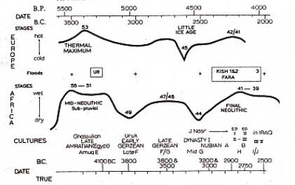
picture 2: “Hot” pluvials of the Saharan Neolithic, reproduced from Schove, D.J.: op. cit., p. 39
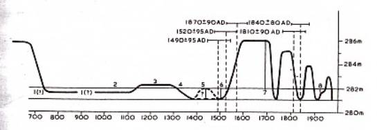
picture 3: Lake Chad levels since about A.D. 700 (After a chematic curve by J. Maley, Palaeoecology
of Africa 9, ed. E.M. Van Zinderen Bakker, 1976.), reproduced from Schove, D.J.: op. cit. p. 39
“In Ancient Egypt periods of famine due to failure of the summer rains in Ethiopia (and probably the Sahel) are recorded with low Nile levels… A fairly continuous curve has been established for the Graeco Roman period…(with) prolonged periods of very low levels A.D. 53/63, 151/170 and 254/265…other low level periods are 253/242 B.C., 192/187 B.C., 139/130 B.C., 50/42 B.C., A.D. 12/19 and 111/124… From A.D. 622 the original Nile records were usually reliable…” (Ibidem, pp. 39,40). A period of weak Nile Floods has been “…reported c.832/842 in Egypt… further runs of weak Niles occurred c.939/953 and 963/968, …in the eleventh century in 1006/1013 and in 1054/1065. (Ibidem, p. 40) Within the period 1131/1145 a drought occurred in Ethiopia, “…evidently corresponding to the period of low Niles reported in Egypt c.1141/44. (Ibidem) Further periods of famine occurred in 1200 (in Egypt), in 1252, 1258, 1272 (in the Sudan) and in 1400/1405 (in Egypt). (Ibidem) Medieval drought periods are known during 758/787, 827/848, 939/950, 1009/1017, 1199/1232, 1281/1335 and 1400/09. (Ibidem) “The onset of the Little Ice Age was ...dated from documentary evidence as c.1590. Although it is now clear that other cold periods preceeded this, the change of climate… seems to have been in sympathy with a change in the Sahel, a change clearly evident in the rise of level of LakeChad from c.282 m about 1570 to c286 m about 1625.” (Ibidem, p. 41; see picture 3)
“The nomadic peoples of the Sahara followed the ancient tradition of giving a name to each year so that it could be orally recited. Such lists of year names are always of interest to meteorologists, and the dry and wet years of the Sahara can be determined by a comparison of different accounts… (These) annals can be interpreted meteorologically by the following formulae based on comparisons at Tamanrasset:
- Exeptional pasture 150 mm (of precipitation)
- Abundant 100 mm
- Satisfactory 50 mm
- Average 40 mm
- Mediocre 30 mm
- No pasture 20 mm or less”
(Ibidem, p. 42) Could such deductions be applied to the Eastern Sahara of the past? “The northern limit of the summer rains of the south Sahara is a very sharp one, and today the northern limit of settlement is generally the 15th Parallel… The northward decrease of rainfall is illustrated in the Upper Nile region. At El Obeid (13 degrees N) in Kordofan rainfall averages 300 mm, at Khartoum (15 degrees N) it averages 150-175 mm, whilst at Merowe (18 degrees N) it is only about 25 mm. Near 18 degrees N the desert now is almost uninhabited.” (Ibidem, p. 38) A very slight movement of the limit of the summer rains “…makes all the difference between the plenty and starvation to the people of the Sahel.” (Ibidem)
Is it conceivable that during the times of our Stone Age forebears (here: 3,200-3,100 B.C.) the 20 mm isohyets (which may represent the minimum amount of rain necessary to produce colcynths) occasionally shifted way north into the Eastern Sahara causing weather patterns, which led to broad scale record-breaking downpours? Or were there occasional pockets of rainfall at totally unexpected times that created, here and there, carpets of vegetation, to which, following the path of the rain, users of Clayton rings were heading for, although such places offered nothing but a chance of basic survival? Furthermore, is it imaginable that (late winter and/or early spring) seasonable rainfalls of the Terminal Humid Phase (Kuper, Kröpelin), the latter succeeding the “…intense daytime summer monsum rains of the early Holocene pluvial… “ (Kuper, R.; Kröpelin, quoted below, p.806), extended well into the hyper arid phase, presumably falling at night and, therefore, causing more vegetation to grow? (Ibidem) If this was the case, such winter rains must have spread across the Libyan Desert in times, when the area was supposed to have turned into a barren waste, promoting “long term” favorable conditions for Clayton ring users.
On 8/18/2006 Friedrich Berger informed me of an article (Climate-Controlled Holocene Occupation in the Sahara: Motor of Africa´s Evolution. Science, vol. 313, 11. August 2008, pp. 803-807), in which Kuper and Kröpelin, once again, present the results of their decade long endeavours in the Eastern Sahara. On page 807 the two authors, referring to the period 5,300 B.C.E., state: “The geological archieves in agreement with the archaeological evidence indicate a gradual desiccation and environmental deterioration of the Eastern Sahara, notwithstanding transitory climatic perturbations that are a common feature of all desert margins. This rather linear process culminates in the present extremely arid conditions.” Would such transitory climatic perturbations suffice to explain the ubiquitous presence of Claytons in the Western Desert of Egypt? If this is the case, these perturbations, prevailing during a quarter of a millennium, must have been everywhere.
C. Reproduction cycle of colocynthsIn April 2006 Alessandro Menardi Noguera, Pavia, Italy, noticed blossoming colocynths on the Libyan side of Gebel Uweinat. In October 2005 Andras Zborray found newly grown colocynths in Karkur Thal. According to K.P. Kuhlmann (pers. com.) the last rainfall at Uweinat occurred about 20 years ago, which would indicate that the survival of the handal seeds has to be measured in decades.
I would be grateful to receive more information on this important issue. Please contact Carlo Bergmann, Am Neidenbach 1, D54655 Malberg, Germany.
D. On “Kam´a” or “Faqa´a”
A few days ago, Mahmoud Marai (Cairo) informed me that “Faqa´a” is the Eastern Desert´s name of a mushroom like plant, which the Bedoin of the Egyptian Western Desert call Terfas. Gustav Nachtigal has incorporated such a plant (botanical name: Choeromyces Leonis) in his list of wild plant food of the poor. (Nachtigal, G. op. cit., p. 129) „The species of the Terfezia genus, together with Tirmania, are called desert truffles…They are a few centimetres across and weigh from 30-300 grams. They are usually found in wintertime after rainfall.” (http://en.wikipedia.org/wiki/Desert_truffels) In Egypt, according to Mahmoud, the fruit, which is believed to evoke strong sexual powers, is commonly sold to Arab Kuwaities and to Saudies at high prices.
E. Note concerning the treatment of a discovery made in March 1989
On 15th March 1989 I discovered several pottery hills dotted along the wayside of an old caravan road, which (running from southeast to west) by-passes the difficult Kharafish area situated on the Limestone Plateau north of Dakhla oasis. (For locating my position of 3/15/1989 see picture 4 – expedition 1988/89 map segment of Survey of Egypt 1: 500,000, Sheet 8, Kharga, left side)
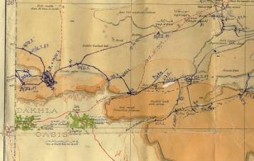
picture 4: segment of expedition map 1988/89
At the foot of two of the hills numerous pot-sherds were scattered. At one of them I found a number of Clayton rings + discs and, on its slopes, fragments thereof. (pictures 5-7) A much eroded rock picture was also observed. On account of the shape of the enigmatic objects I named the site “Käseglockenhügel – Cheese-cover Hill”.
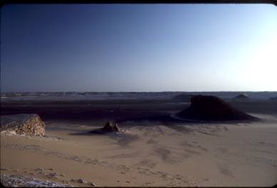
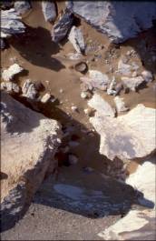
picture 5: Cheese-cover Hill at the fringes of El-Kharafish picture 6: Clayton rings at the foot of Cheese-cover Hill
picture 7: Approaching Cheese-cover Hill from the west-southwest
Because of the importance of the find I documented it properly, donating to it several notebook pages. (pictures 8-14)
pictures 8-10: my notebook of expedition 1988/89, pages 981-983 “Cheese-cover Hill”
pictures 11 + 12: my notebook of expedition 1988/89, pages 984 + 985 “Cheese-cover Hill”
pictures 13 + 14: my notebook of expedition 1988/89, pages 992 + 993 “Cheese-cover Hill”
Back in Germany I informed Kuper and the Cologne prehistorians, but the find did not arise the slightest interest. It took years until Riemer (from the same team) approached me and inquired about places, at which I had seen the egnigmatic rings.
In 1988/89 I had navigated with the help of map & compass. On 2/12/1991, when passing by Cheese-cover Hill a second time, I navigated the same way. As Riemer wanted precise coordinates of the site, I agreed to walk to the hill a third time. The hike took place at the end of October 2000. I was acompanied by Heino Wiederhold, a retired banker, with whom, two years later, I marched to the Gilf Kebir. We arrived at Cheese-cover Hill on 10/30/2000 (see picture 15), took a GPS-waypoint and continued to the Cologne team´s research house at Balat/Dakhla oasis.
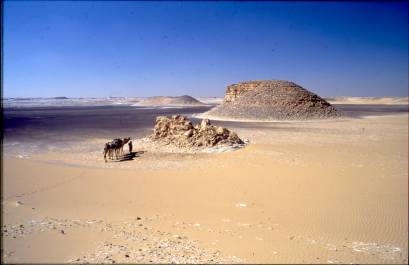
picture 15: Heino Wiederhold and my camels at the rock outcrop east of Cheese-cover Hill
At the research house or, later (shortly after my winter 2000/2201 expedition), in Cologne (I don’t remember exactly) I gave Riemer the geographical coordinates and a description of the sites along the old trail in fair promises that, if he would work on the sites and publish results, I would be mentioned as the discoverer.
To my surprise, a fortnight ago, I came across an article of Riemer et al. in Antiquity, in which a picture of Cheese-cover hill strikes the eye. (Riemer, H.; Pöllrath, N.; Nussbaum, S., Berke, H.: The fire makers of El-Kharafish: a late prehistoric camp site in the Egyptian Western Desert. Antiquity, vol. 80, No 307, March 2008; see picture 16) In this image (which is fairly alike pictures 5 + 15) the Cologne team´s 4WD replaces my caravan.
picture 16, reproduced from http://antiquity.ac.uk/projgall/riemer/index.html
Riemer et al. named the site “El-Kharafish 02/5”. Therefore, I assume that the Cologne team went to Cheese-cover Hill in 2002 for the first time.
In appendix (Anmerkungen zu Claytonringen) of my “Wilkinson´s zweites Zerzura”-Report published on 6/5/2003 on my website (www.carlo-bergmann.de) I refered to the Cheese-cover hill discovery, writing, the following in an abstract way, so as not to interfere with Riemer´s publishing intentions:
„Auch anderswo hatte ich Claytonringe immer im Zusammenhang mit Stationen an alten Wegen oder entlang von Alamatlinien zu Gesicht bekommen. Nördlich von Dakhla, auf dem Kalksteinplateau, traten sie entlang eines antiken Weges derart eng gestaffelt auf, dass sie nur mit dem „Zur-Strecke-Bringen“ von Gazellen in Verbindung gebracht werden konnten. Auf jeden Fall: sie haben mit ziemlicher Sicherheit etwas mit der Versorgung von Menschen in den antiken Karawanen zu tun.“ (my translation: Elswhere I had seen Claytons always in association with way-stations belonging to old trails or lines of alamat. North of Dakhla, on the Limestone Plateau, they occurred along an ancient road in dense intervals, so that their presence only could be related to gazelle trapping/hunting. In any case, Clayton rings most certainly have something to do with (food)supply in ancient caravans.)
If Riemer ever had forgotten about it, would the above text not have reminded him of the correct authorship of the discovery? In the Antiquity article there is no mention of my name. It has been omitted. This is another sad example for stealing one of my discoveries.
Malberg, 4th September 2006
P.P.S.: Follow-up concerning the “Cheese-cover Hill” incident
1.) On 9/4/2006 I complained about the suppression of my discovery at ANTIQUITY, sending the above text including documents to the editor.
2.) Prof. Martin Carver wrote: “Dear Dr. Bergmann, Many thanks for your letter. I feel sure it was an oversight, but if you wish to contact Dr. Riemer his email adress is heiko.riemer@uni-koeln.de. With all good wishes. Martin Carver.” (9/6/2006)
3.) The following day I replied: “Dear Martin Carver, thank you for your mail. Concerning my discoveries in the Western Desert of Egypt there have been, until now, three cases, where Dr. Riemer has omitted my name. Therefore, it is more than likely that it was not an oversight that, in case of the discovery of “Cheese-cover Hill” at El-Kharafish, my name was left out. Even if this was the case, a false piece of information has been placed in the public realm. An exchange of opinion & facts with Dr. Riemer, as you have suggested, would not help to change this. Would it, thus, be not fair to print a small note in the next issue of ANTIQUITIES (for instance as a comment or as a letter to the editor), which would inform your readership about the correct facts? Kind regards, Carlo Bergmann”
4.) Prof. Martin Carver answered: “Dear Dr. Bergmann, I am sorry that you have not been acknowledged by Dr. Riemer, but I am in no position to judge the merits of the case, and it is not appropriate for Antiquity to intervene on the matter. If you have specific comments on the data or interpretations offered in the article, by all means put them in a Letter to the Editor, and I will happy to consider it for publication. Yours sincerely Martin Carver.” (9/7/2006)
5.) My reply of 9/13/2006:
“Re.: suppression of my name concerning a discovery made in March 1989 in El-Kharafish, Egyptian Western Desert
Dear Professor Carver, thank you for the polite way of rejecting the clarification of my authorship of the above discovery in ANTIQUITY. In 1933 Count Ladislaus Almasy found support, when defending his claim of having discovered the famous rock-art at Ain Dua/Gebel Uweinat against the assertions of Italian Count Ludovico Caporiacco and, later, of German Prof. Leo Frobenius. Obviously, these times when high ethical standards in science prevailed are gone. We have discussed the case here in Berlin and have decided to put the issue, including our exchange of emails, on my website in order to warn the public about dubious claims & procedures. If a science-magazine itself is not in the position to correct a fraud published in it, who else should do so? Every discoverer should think twice before handing out, what he as found, to archaeologists. Kind regards, Carlo Bergmann.”
P.P.P.S.: Further notes on Colocynths & on rainfall at Gebel Uweinat
Contemplating on grinding stones, Arnold Hoellriegel refers to a method of crushing and grinding „… the bitter pips of the colocynth, a pumpkin like fruit of the steppe, from which female Tibu commonly prepare dough.” (my translation; Hoellriegel, A.: Zarzura, die Oase der kleinen Vögel. Zürich1938, p. 179)
Refering to Bedouin narrative Count Ladislaus E. Almasy informs us that, in the past, rain usually had fallen at Gebel Uweinat every five years. “The last rain fell there in 1925. Finally, in summer 1937, heavy thunderstorms hit Uweinat and the northern section of the Gilf Kebir.” (my translation; Almasy, L.E.: Schwimmer in der Wüste. München 1999, p.225)
Edeltraud Niedermüller (Stuttgard) sent me a photograph, displaying a spot of dried playa of former “steppe country” partly covered with colocynth. The place, which is situated between dunes, was seen north of Agadez.
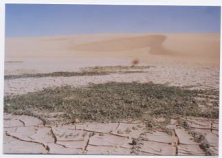
Malberg, 14th. September 2006